


Thrissur kole lands
A Kole land is part of the unique Vembanad Kole wet land eco system in Kerala. The kole lands are located in the Central Kerala that spreads over Thrissur and Malappuram districts. In olden days the kole lands were reclaimed from kayal area by putting up temporary earthen bunds and cultivation of rice were done by enterprising farmers during summer period from December to May. Peculiar type of cultivation carried out from December to May is “Kole” and means “Bumper yield”. It contributes to forty percentage of rice production in the state. Rice Cultivation in Kole land started in 18th century. Temporary bunds were constructed around each plots (padavu) in this Kayal land and dewatered and used for cultivation during December to May. Dewatered waters from Padavu were stored in canals/drainage networks between these padavu and used in later stage for irrigation. But this is insufficient and only with the help of good summer showers farmers get good yield.
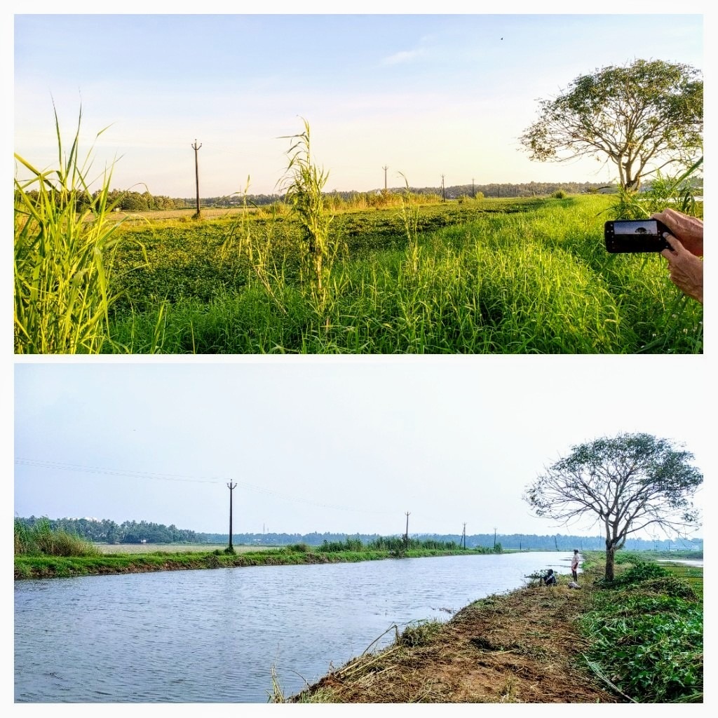
In Thrissur district, 13000 Ha of kole land are extending between Kechery river and Karuvannur river. Kole land lie below the mean sea level ranging from 0.5m to 2.5m. Majority of the kole land in Thrissur Taluk and a small portion in Thalappilly Taluk are lying very near to sea. As these lands are low lying areas, a day long rain is enough to bring the land under flood. During the monsoon season, the entire area resembles a vast sheet of water inundation and would remain in this stage for nearly six months and during this period, the entire land lies submerged under water. Flood water enters through chemmeen chal, Peramangalam chal etc. from Kechery river. It enters through Herbert canal, Chirakkal thodu, Link canal etc from Karuvannur river to north zone. Entry to south zone is through Thamaravalayam canal, Thommana etc. Exit for this flood water is through Enamakkal, Idiyamchira and Koothumakkal regulators.
The soil in the kole lands are classified under the category of acid saline soil as it is acidic and contain elements of sodium chloride. The soil also contains elements of iron, aluminium, manganese and sulphur. By constructing temporary bunds at Munayam, Enamakkal and Idiyanchira, salt water intrusion to the agricultural land is prevented to a great extent. Now, instead of temporary bund at Munayam, the works of a permanent regulator cum bridge across Karuvannur river connecting Kattoor and Thannyam Panchayath is under progress (NABARD - RIDF XXIII – Saline Ingress Prevention by construction of Regulator at Munayam across Karuvannur river). With the construction of this RCB, 3000 Ha of kole land with double crop, fish farming etc. can be achieved. About one lakh people in Nattika and Irinjalakuda Constituency can utilize this bridge and thereby increase the facility for communicatation. This RCB is proposed for retaining water to a height of 5.5 m with a length of 82m using 6 shutters of 12m length.
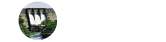
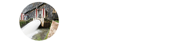
The source of irrigation water for the kole land area are Peechi irrigation project, Vazhani Irrigation Project and Chimoni Irrigation Project. Water released from Chimoni is stored and diverted to Kole lands with regulators constructed at Illikkal and Kottenkottuvalavu. The water headed up is directed to north zone through link canal, Herbert canal, Chirakkal thodu, Perumpuzha chal, Chettupuzha chal etc. Irrigation supply to south zone is through Neeroli thodu, Nandi thodu etc. Total length of these canal is approximately 170 Kms. Canals in Kole land act as drainage channels during flood season channelizing flood water to outlets at Enamakkal, Idiyanchira, Koothumakkal.
Sluices and Regulators along these canal network can be used for controlling flow in fields, canals and rivers. Lifting devices like Petti & Para or Motor & Pump are used for pumping. Petti & Para is the indigenous pumping device used for dewatering fields. It is now replacing with axial flow pumps.