


Chamravattom Regulator Cum Bridge
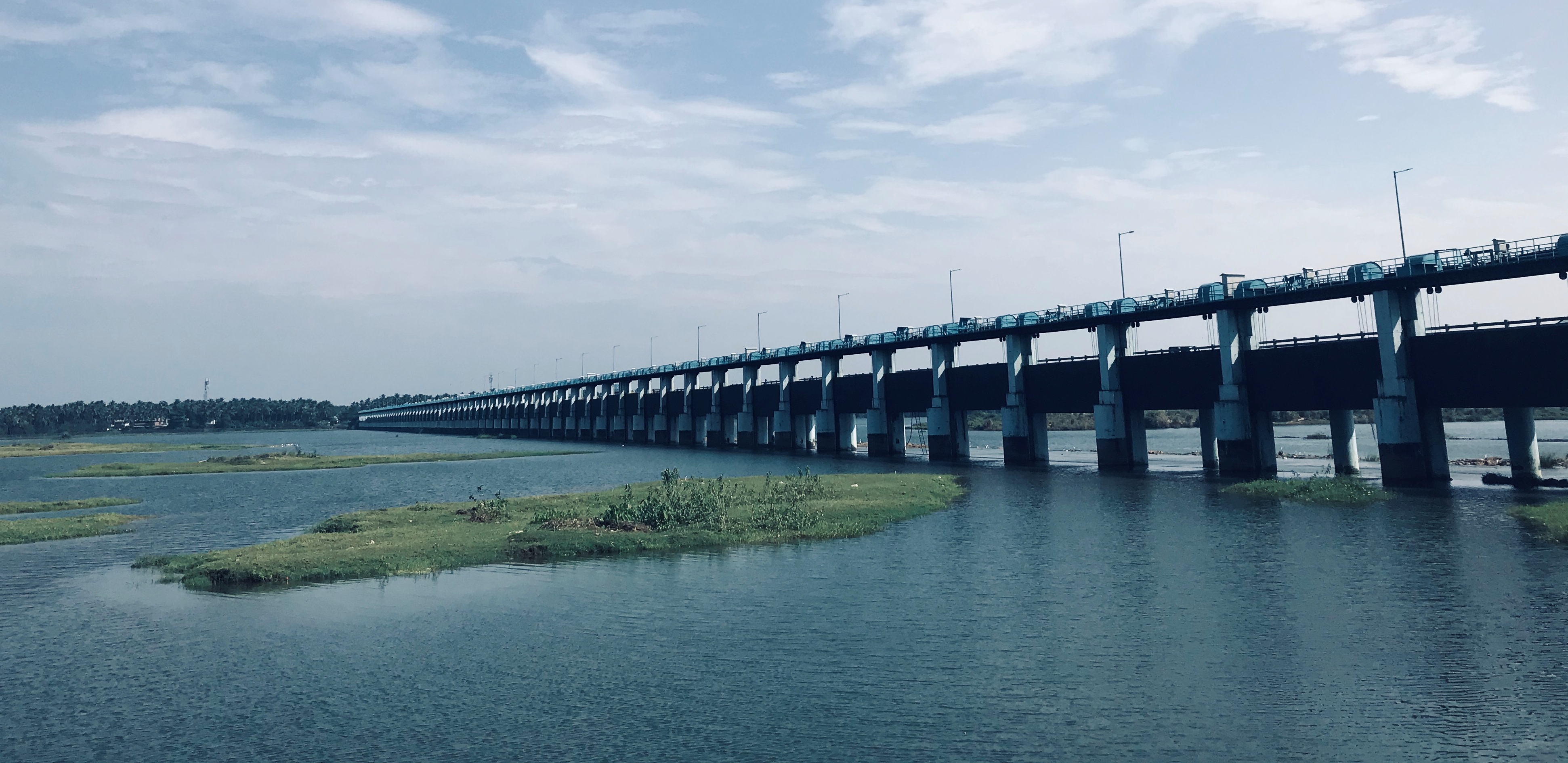
Regulator cum bridge, Chamravattom is a multipurpose project with 978m length and 70 spans. This bridge could reduce the distance between Kozhikode and Ernakulam districts by 20m. Other main objectives of this project are, providing irrigation to 9659 Ha. land in Tirur and Ponnani taluks and supplying drinking water to 14 panchayaths near Tirur and Ponnani municipalities.
| SALIENT FEATURES | |
|---|---|
| Location | Chamravattom. |
| Taluk | Tirur & Ponnani |
| District | Malappuram |
| Length of river | 1000 m |
| Length of bridge | 978 m |
| Number of shutters | 70 |
| Size of shutter | 12.00 x 4.00 m |
| R.L of Apron | +1.50 |
| R.L of shutter top | +6.00 m |
| R. L of Weir | +2.00 m |
| F.R.L | + 6.00 m |
| Reservoir capacity | 24.49 Mm3 |
| Water spread area | 869 Hectares. |
| Top level of flood bank | +6.60 m |
| Width of road | 7.50 m |
| R.L of road | +9.35 m |
| Maximum flood discharge | 8496 cumecs. |
| Maximum rainfall | 4528 mm |
| Minimum fainfall | 1793 mm |
| Ayacut area | 9659 Hectares |
| Drinking water | 63.5 MLD |