


Pazhassi Irrigation Project
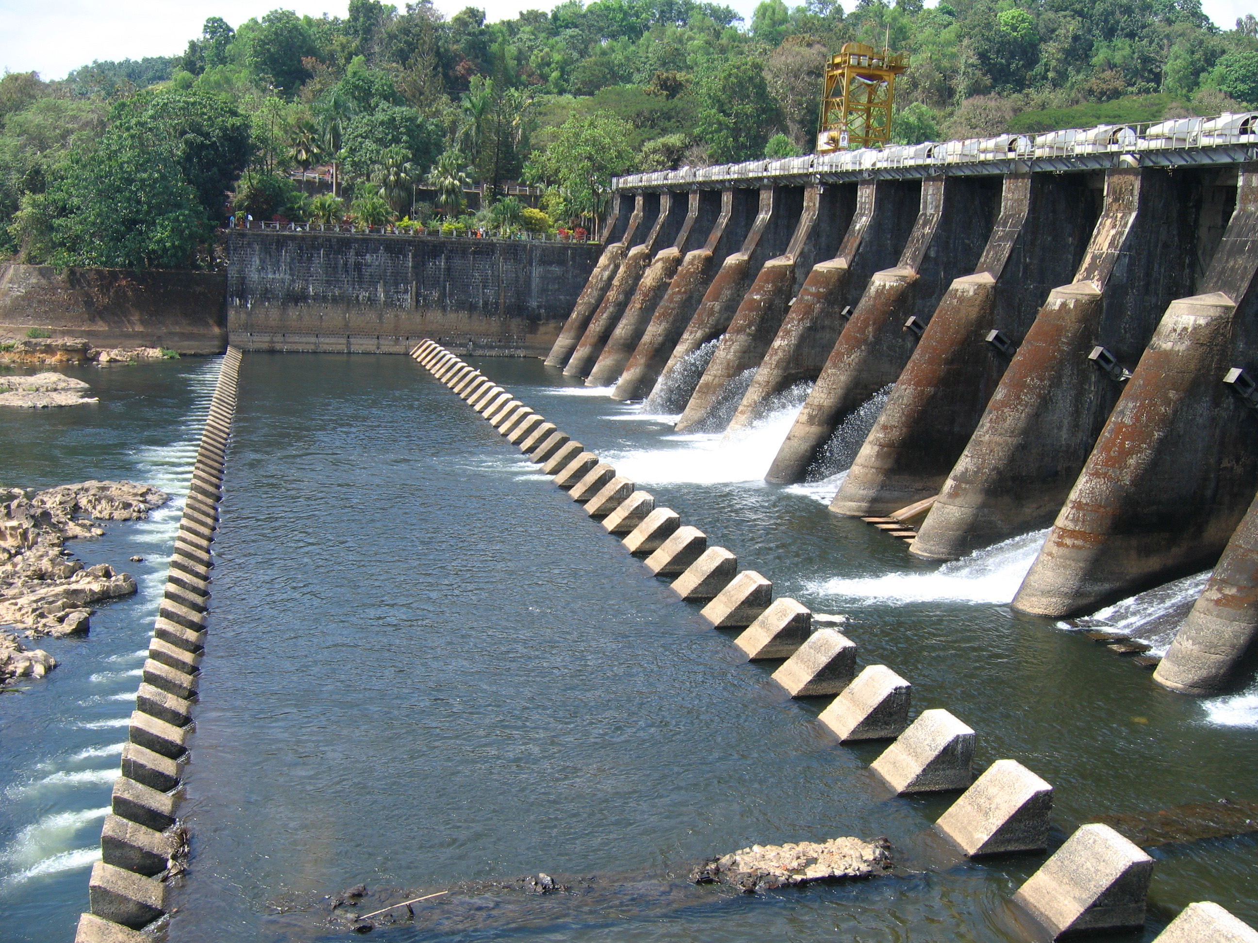
Pazhassi Irrigation Project is the first Irrigation project in the Northern Region of State of Kerala. This major project was envisaged to stabilize 16500 hector of paddy fields spread over four out of five taluks, namely Iritty, Thalassery, Kannur and Thaliparamba of Kannur district. The project was declared to be completed during the year 1998. The project consists of a diversion Barrage at Kuilur across Valapattanam River, main canal on left side for 46 kilometer length, six branch canals of 75 kilometer total length, Distributaries of 165 kilometer total length and field bothies of 118 kilometer total length. The head works is a barrage across Valapattanam River at Kuyiloor located 38 km away from both Kannur and Thalassery Railway stations. The valapattanam River originates from Westem Ghats and drains to Arabian Sea in Kannur' The river has a catchment area of 730 square kilometer of which 528 square kilometer lies in Karnataka State. The river has a lenglh of 113 kilometre with an annual runoff estimated as 3450 TMC.The location of barrage is in between longitudes 75o 2A'&75o 43'E and in between latitudes 11o 36' and 12"2" N' Nearest town is Mattannur. The reservoir is also the sources around 12 drinking water schemes of KWA in Kannur distnct and Mahe. Moreover a mini hydal project of 7.50 MW capacity is started by the KSEB using the reservoir water'
| Details of Dam Engineers | ||
|---|---|---|
| Chief Engineer | Chief Engineer (Projects I) | |
| Superintending Engineer | Project Circle kannur | |
| Executive Engineer | PYIP Division II Kannur | |
| General | |
|---|---|
| District | KANNUR |
| Taluk / Village | Thalassery |
| Latitude | 11° 5939' 00" North |
| Longitude | 75° 3739' 00" East |
| River | Valapattanam river |
| Structural Features of the Dam | |
| Type | Masonry barrage. |
| Top Width (Bulk Head) | 5.49 M |
| Bottom Width (-do-) | 14.02 M |
| Length | 245 M |
| Maximum Height from bed level | 18.29 M |
| Slope :Upstream | Vertical |
| Down stream | 2:1. |
| Hydrological Features of the Dam | |
| Catchment Area | 640 Sq.Km |
| Probable Maximum Flood (PMF) | 3500 cumecs |
| Method of Estimating PMF | Unit Hydrograph |
| Spillway | |
| Location | Kuiloor |
| Type | Masonry |
| Total Length | 138 M |
| Crest Level | 13.72 M |
| Design Capacity of spill way | 3500 cumecs |
| Number, type and size of gates | 16 nos. Radial (6.1 x 5.18 M size) |
| Reservoir Features | |
| Top Bank Level | 27.52M |
| Maximum Water Level | 27.44 M |
| Full Reservoir Level | 26.52 M |
| Minimum draw down level | 24.66 M |
| Dead Storage Capacity | Nil |
| Gross storage capacity | 97.5 Mm3 |
| Free board over F R L | 1 M |
| Free board over M W L | 1.48 M |
| Area of Reservoir at F R L | 650 Ha |
| Head Sluice | |
| Spill way | 24.66 M |
| Spill Channel | Nil |
| Instrumentation | Electrically operated radial |