


Pothundy Project
The Pothundy project commissioned during 1967 consists of ;
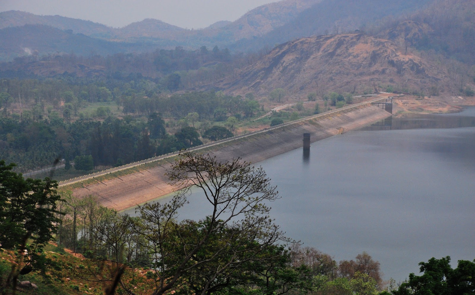
1.An earth dam across the tributaries of Ayilur river mainly, Meenchadypuzha and Paddy puzha originating from theNelliyampathy Hills.
2.A masonry spillway at right flank of the dam for surplussing the flood discharge and other appurtenant works.
3. Two main canals, their branches and distributaries to irrigate 4986 Ha.lands in Chittur and Alathur Taluks of Palakkad district.
The dam is 1680.00 m in length and the reservoir has a water spread area of 4.14 sq Km and live storage capacity of 43.90Mm³ at FRL of 108.2m. There are two sluices for regulating water in the main canal that take off from the Dam,viz,RBC & LBC. The Right bank canal is having (1) a main canal of length10.50 Km (2) 16 branches of length about 56.20Km (3)and number of spout of about 236nos (both direct sluice and field boothies) feeding an ayacut area of 2711.55Ha. and the Left bank is having (1) a main canal of length8.3Km (2) 8 branches of length 37.65Km (3) and number of spouts of about 165nos (both direct sluice and field boothies) feeding an ayacut area of 2074.05Ha.The command area of the project lies in panchayaths of 1)Nemmara 2) Ayilur 3) Melarkode 4) Elevencherry 5)Vadakencherry 6) Vandazhy and 7) Erimayur.
The canal system is designed with duty of 990 Ha/cumecs with a provision of 16.25% of transmission losses. The discharge of LBMC and RBMC are 3.30m3/s and 3.20 m3/s respectively.
Purposes
Irrigation
Water through the dam is distributed for irrigation through the RBC and LBC canals in the ayacut areas of 7 panchayathsviz, Nemmara, Ayilur, Elevencherry,Melarkode,Vadakencherry, Vandazhy and Erimayur.The monetary benefit derived from the yield of paddy and other crops in these areas, every year, is a multy million figure .
Drinking Water Supply System
The water from the Pothundy dam is also used for Drinking Water supply of 3 panchayathsNemmara,Ayilur, and Melarkode,by the Kerala Water Authority since 1984. Now, the designed daily consumption of water and number of consumers for the project is 125 lakhs litres per day and 1,31,659nos respectively.
Fisheries
Pothundy Dam is also used for cultivating variety of fishes under the department of fisheries.As per fisheries department revenue from sale of fishes comes to about 10 to 15 lakhs per year.
Water Distribution System
Water is being distributed through the Left and Right Bank canals mainly for paddy, which is being cultivated in 90% of the ayacut area. Crops like coconut,plantain, areca nut,vegetables,pulses,rubber, and tapioca are also grown.
Water is being distributed continuously in the main canals for the entire base period of the crop depending on the availability of water in the dam and the request of the farmers. Water is being released into the branch canals in a turn system. The entire canal system is divided into two turns to feed the ayacut in intervals.
| Details of Dam Engineers | ||
|---|---|---|
| Chief Engineer | Chief Engineer (Projects I) | |
| Superintending Engineer | Siruvani Project Circle Palakkad | |
| Executive Engineer | Irrigation Division Malampuzha | |
| General | |
|---|---|
| State | Kerala |
| District | Palakkad |
| Taluk/ Village | Chittur |
| Latitude | 10° 32.5' North |
| Longitude | 70° 36.5' E |
| River | Ayilur (Tributary of Bharathapuzha ) |
| Structural Features of the Dam | |
| Type | Homogenous Earth Dam |
| Top width | 7.32 m |
| Bottom width | 133.8 m |
| Length | 1680 m |
| Maximum height from bed level | 32.61 m |
| Slope - upstream amp; downstream | 2:1, 2:1 |
| Hydrological Features of the Dam | |
| Catchment Area | 31 sq.kms |
| Probable Maximum Flood | 680 cumecs |
| Method of estimating PMF | Current Meter Method |
| Spillway | |
| Location | Right Flank of Dam |
| Type | Gravity Type with Ogee Curve |
| Total length | 40 m |
| Crest Level | +104.09 m |
| Design Capacity of Spillway | 682.44 cumecs |
| Number, Type, amp; Size of Gates | 3, (12.19X 4.11), Level shutters |
| Reservoir Features | |
| Top bank level | +110.642 m |
| Maximum water level | +108.204 m |
| Full reservoir level | +108.204 m |
| Minimum draw down level | 91.44 m |
| Dead storage capacity | 7.014 Mm3 |
| Gross storage capacity | 50.914 Mm3 |
| Freeboard over FRL | 2.42 m |
| Area of reservoir at FRL | 2.75 sq.kms |
| 6. Head Sluice | |
| Sillevel | +91.44m |