


Kallada Irrigation Project
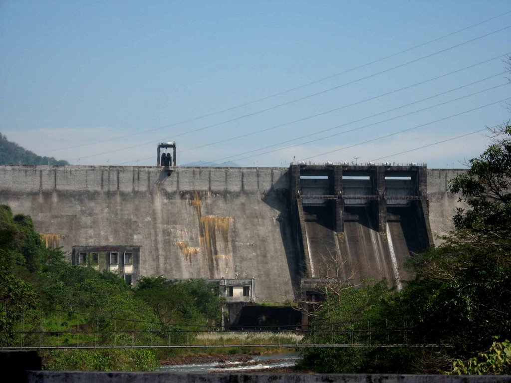
Kallada irrigation and Tree crop development scheme is the largest irrigation project in the State of Kerala. The dam was commissioned on 1986. Our mission is to ensure water in the canals for irrigation and power generation, flood control and safety of the dam. This project comprises of straight gravity masonry dam across the Kallada river, at Parappar near Thenmala in Kollam District at 80 57’ N Latitude and 77 0 04’ 20’’ E Longitude. It is situated 19 Km from Punalur and 2 Km from Thenmala railway station. The distance to nearest Airport from Dam is 115 km.
The total length of dam is 335 m and height from the deepest foundation is + 85.35 m. The dam was made up of 12 blocks, serially numbered from left to right. The total length of spillway is 42.06 m (which includes 3 Nos. gated ogee type spillway of size 12.19 m x 9.14 m). There are two non-overflow masonry sections dam on either side of the spillway. The length of earthen dam is 225.7 m. and has a maximum height of 12.51m from the lowest foundation level. The lowest foundation level is +106.39 m and dam top level is + 118.90m. The type of saddle dam is impervious fill.
The canal network comprises of Left Bank Main canal of length 56.016 km, Right Bank Main canal of length 69.752 km, Left Branch Canal of length 61.692 km, Right Branch canal of length 47.573 km. distributaries and minors.