


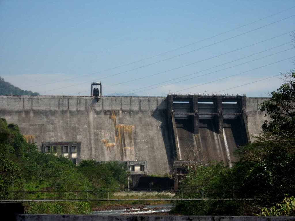
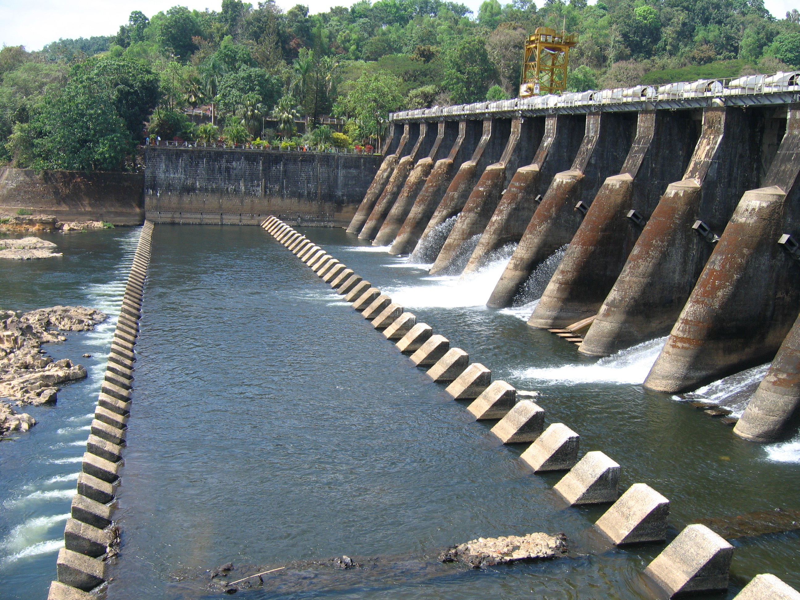
NEYYAR IRRIGATION PROJECT

| Details of Dam Engineers | ||
|---|---|---|
| Chief Engineer | Chief Engineer (Projects II) | |
| Executive Engineer | Irrigation Division, Thiruvanathapuram | |
| Assistant Executive Engineer | NIP Channel Sub Division | |
| Assistant Engineer | Neyyar Dam Section | |
| General | |
|---|---|
| State | Kerala |
| District | Thiruvananthapuram |
| Taluk/Village | Neyyattinkara |
| Latitude | 8° 32' North |
| Longitude | 77° 09' East |
| River | Neyyar |
| Structural Features of the Dam | |
| Type Straight Gravity Type- Masonry | Dam |
| Top Width | 7.54 m |
| Bottom Width | 30.02 m |
| Length | 295 m |
| Maximum height from Bed Level | 56m |
| Slope - Upstream amp; Downstream | |
| Hydrological Features of the Dam | |
| Catchment Area | 140 sq. km |
| Probable Maximum Flood | 809.4 Cumecs |
| Method of estimating PMF | |
| Spillway | |
| Location | Middle of Masonry Dam |
| Type | Ogee |
| Total Length | 34.60 m |
| Crest Level | 79.55 m |
| Design Capacity of Spillway | 809.4 Cumecs |
| Number, type and size of gates | 4, Radial Type, 8.69 X 5.18 m |
| Reservoir Features | |
| Top Bank Level | 85.645 m |
| Maximum Water Level | 84.75 m |
| Full Reservoir Level | 84.75 m |
| Maximum Drawdown Level | 65.00 m |
| Dead Storage Capacity | 10.52 Mm3 |
| Gross Storage Capacity | 106.25 Mm3 |
| Freeboard over FRL | |
| Freeboard over MWL | |
| Area of reservoir at FRL | |
| Head Sluice | |
| Sill level | LBC +59.70 m, RBC +56.65 m |
KALLADA IRRIGATION PROJECT
| Details of Dam Engineers | ||
|---|---|---|
| Chief Engineer | Chief Engineer (Projects II) | |
| Executive Engineer | KIP RB Division, Kottarakkara | |
| Assistant Executive Engineer | KIP (RB) Subdivision No:2 Thenmala | |
| Assistant Engineer | KIP (RB) section No.3/2 Thenmala | |
| General | |
|---|---|
| State | Kerala |
| District | Kollam |
| River | Kallada |
| Latitude | 77°4'20" East |
| Longitude | 8°57'00" North |
| Hydrology | |
| Annual Rainfall | 305cms |
| Catchment area of Reservoir | 549sq. km |
| Reservoir | |
| Name of Dam | Kallada(Parappar) |
| Construction Started | 1972 |
| Completed | May 1986 |
| Type of Dam | Masonry straight gravity with spillway |
| Length of Dam | 335m |
| Length of Overflow section | 42m |
| Length of non-overflow Section | 393m |
| Maximum height above | |
| deepest foundation | 85.35m |
| Top width of Dam | 7.62m |
| Top of Dam (roadway) | +118.87m |
| Top level of Parapet | +119.87m |
| Full Reservoir Level | +115.82m |
| Maximum Water Level | +116.77m |
| Low Water Level | +70.25m |
| Tail Water Level | +69.65m |
| Gross Storage at FRL | 524 Mm3 |
| Gross Storage at MWL | 536 Mm3 |
| Live Storage at FRL | 507 Mm3 |
| Dead Storage Capacity | 17.00Mm3 |
| Water Spread area at FRL | 23SqKm. |
| Type | Gated Ogee Type |
| Type of Crest Gates and Size | Radial 12.19m acute; 9.14m |
| Number of Crest Gates | 3 Nos |
| Crest Level | +106.68m |
| Head Over Crest | 9.14m |
| Design Discharge | 2830cumecs |
| Capacity of low level Outlets | 3.75m diameter conduit with sill level + 70.25m amp; discharge capacity 60 cumecs |
| Auxiliary spillway without control gates | |
| Location | Right flank of Masonry Dam |
| Length | 56.00m |
| Crest level | +116.73m |
| Design discharge 689m3/sec | |
| Type | Labyrinth weir |
| Gates | No gates, freeflow |
| Saddle Dam | |
| Length | 225.70m |
| Maximum Height | 12.51m |
| Pick-up Weir | |
| River Sluice | 1 No. (2.44 size)acute; 1.83m |
| Length of Weir | 120.69m |
| Crest Level | +63.09m |
| Deepest bed level | +57.50m |
| Width of roadway over weir | 4.27m |
| Number of span | 7 |
| Maximum upstream flood Level | +68.45m |
| Maximum D/s flood level | +65.84m |
MALANKARA DAM PROJECT
| Details of Dam Engineers | ||
|---|---|---|
| Chief Engineer | Chief Engineer (Projects II) | |
| Executive Engineer | MVIP Division No. 3, Muvattupuzha | |
| Assistant Executive Engineer | MVIP Sub Division no. 1, Muttom | |
| Assistant Engineer | MVIP section 2/1, Muttom | |
| General | |
|---|---|
| State | Kerala |
| District | Idukki |
| Taluk/Village | Thodupuzha/ Muttom |
| Latitude | between 9°37 and 10°4; North |
| Longitude | between 76° 26 and 76° 49, East |
| River | Thodupuzha (Tributary of Muvattupuzha) |
| Year of Completion | 1994 |
| Structural Features of Dam | |
| Type | Straight Gravity Rubble Masonry, Earthen |
| Top Width | Masonry 5.00m, Earth 6.90m |
| Bottom Width | 16.70m |
| Length | Masonry 254m, Earth 206m |
| Maximum Height | Masonry 23.0m, Earth 12.00m |
| Slope upstream down stream | |
| Hydrological Features of Dam | |
| Catchment Area | 153.5sq.km |
| Probable Maximum Flood | 1444.32 cumec |
| Spillway | |
| Location | |
| Type | Ogee with radial gate |
| Total length | 62.1 |
| Crest level | +36.900m |
| Design capacity of spillway | 1442.32 Cumecs |
| Number, type and sizes of gates | 6 nos, Straight 7.6 x 6.40 m |
| Reservoir Features | |
| Maximum water level | +43.00m. |
| Full reservoir level | +42.00m. |
| Minimum drawdown level | +39.00m. |
| Dead storage capacity | 27 Mm 3 |
| Gross storage capacity | 38.00 Mm 3 |
| Freeboard over F.R.L | 3 |
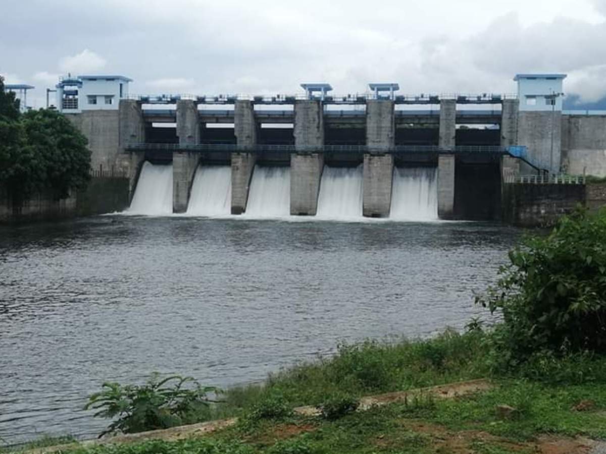
CHIMONI DAM PROJECT

| Details of Dam Engineers | ||
|---|---|---|
| Chief Engineer | Chief Engineer (Projects II) | |
| Executive Engineer | Irrigation Division, Thrissur | |
| Assistant Executive Engineer | Chimoni Dam Project Sub Division, Echippara | |
| Assistant Engineer | Assistant Engineer, Chimoni dam Project Section No. 1, Echippara | |
| General | |
|---|---|
| State | Kerala |
| District | Thrissur |
| Taluk/Village | Mukundapuram / Varandarappilly |
| Latitude | 10°26'00" North |
| Longitude | 76°28'00" East |
| River | Karuvannur |
| Structural Features of Dam | |
| Type | Masonry Dam Earth Dam |
| Top Width | 6.00M |
| Bottom Width | 7.20M |
| Length | 524.84M 686.50M |
| Maximum Height from Bed Level | 52.82M 29.97M |
| Slope; Upstream Amp; Down Stream U/S 1H to 10v upto + 72.50m 3H to 1v Vertical upto +81.20m; D/S; 0.85H to 1v upto + 50.00m 0.80H to 1v upto + 60.00m 2.5H to 1v 0.75H to 1v upto + 75.00m | |
| Hydrological Features of Dam | |
| Catchment Area | 72.13 KM2 |
| Probable Maximum Flood | 1680Cumecs |
| Spillway | |
| Location | |
| Type | Ogee overflow with radial crest gate |
| Total length | +47.50M |
| Crest level | +72.20M |
| Design capacity of spillway | 1680Cumecs |
| Number, type and sizes of gates | 4 Nos. Radial crest gate ,10 x 7.5m each |
| Reservoir Features | |
| Top bank level | +81.20M |
| Maximum water level | +79.70M |
| Full reservoir level | +40.00M |
| Minimum draw down level | 6.75Mm3 |
| Dead Storage capacity | 6.75Mm3 |
| Gross Storage capacity | 179.39Mm3 |
| Freeboard over F.R.L | 1.50M |
| Freeboard over M.W.L | 1.50M |
| Area of reservoir at F.R.L | 10.10 Sq. KM |
| Head Sluice | |
| Sill level | +40.00M |
PEECHI IRRIGATION PROJECT
| General | |
|---|---|
| State | Kerala |
| District | Thrissur |
| Taluk/Village | Thrissur/ Peechi |
| Latitude | 10° 26' N |
| Longitude | 76° 24' E |
| River | Manali |
| Year of Completion | 1958 |
| Structural Features of the Dam | |
| Type -IF more than one type give | Straight, Gravity Rubble Masonry |
| Details of each type | |
| Top Width | |
| 4.27m | |
| Bottom Width | 34.45m |
| Length | 213.36m |
| Maximum Height | 40.85m |
| Slope- Upstream amp; Down stream | 1in.18m amp; 1in 0.65m |
| Hydrological Features of the Dam | |
| Catchment Area | 18615.50 Ha |
| Probable Maximum Flood | 368.119Cumecs |
| Spillway | |
| Location | |
| Type | Ogee overflow |
| Total length | 40.20m |
| Crest level | +76.20m |
| Design capacity of spillway | 368.119 Cumecs |
| Number, type and sizes of gates | 4 nos - Straight 10.05 x 3.05 m |
| Reservoir Features | |
| Top bank Level | 80.47m |
| Maximum water level | +79.25m. |
| Full reservoir level | +79.25m. |
| Minimum drawdown level | +53.34m. |
| Dead storage capacity | 2.266 Mm3 |
| Gross storage capacity | 110.436Mm3 |
| Freeboard over F.R.L | Nil |
| Reservoir Area at F.R.L | 12.95 Sq..km |
| Head Sluice | |
| Spill level | 55.78m |
VAZHANI IRRIGATION PROJECT
| Details of Dam Engineers | ||
|---|---|---|
| Chief Engineer | Chief Engineer (Projects II) | |
| Executive Engineer | Irrigation Division, Thrissur | |
| Assistant Executive Engineer | Assistant Executive Engineer, Irrigation Sub-Division, Thalapilly | |
| Assistant Engineer | Assistant Engineer, Irrigation Section, Vazhani | |
| General | |
|---|---|
| State | Kerala |
| District | Thrissur |
| Taluk/Village | Thalappilly |
| Latitude | 10° 38' North |
| Longitude | 76° 9' East |
| River | Wadakkanchery |
| Year of Completion | 1959 |
| Structural Features of the Dam | |
| Top Width | 4.55M |
| Bottom Width | 130m |
| Length | 792.48m |
| Maximum Height from bed level | 26.91m |
| Volume Content of Dam Body | |
| Slope- Upstream amp; Down stream | U/S 2.5:1 to 4:1 from top to bottom |
| D/S 2: 1 to 3:1 | |
| Hydrological Features of the Dam | |
| Catchment Area | 20.48 Km2 |
| Probable Maximum Flood | 294.04M3 |
| Spillway | |
| Location | South side of Dam |
| Type | Ogee |
| Total length | 26.48m |
| Crest level | 59.81m |
| Design capacity of spillway | 294.04 m3 |
| 4Nos. Gate shutters | |
| Number, type and sizes of gates | 6.62x2.67m Screw gearing shutter |
| Regulating Gate : 0.90x 1.20m | |
| U/S of wall of 3.10m dia. | |
| Reservoir Features | |
| Top bank Level | +65.53m |
| Maximum water level | +62.48m |
| Full reservoir level | +62.48m |
| Minimum drawdown level | +39.62m |
| Dead storage capacity | 1.471Mm3 |
| Gross storage capacity | 18.12Mm3 |
| Freeboard over F.R.L | 3.05m |
| Reservoir Area at F.R.L | 1.82 Sq. km |
| Free board over M.W.L | 3.05m |
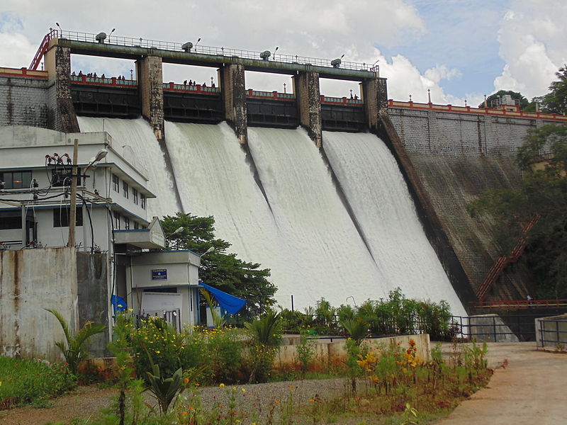
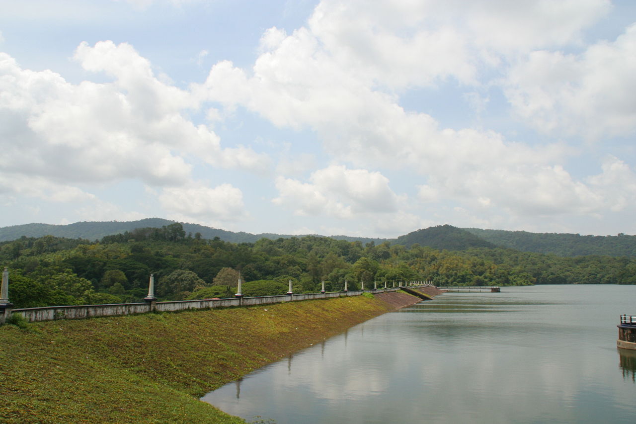
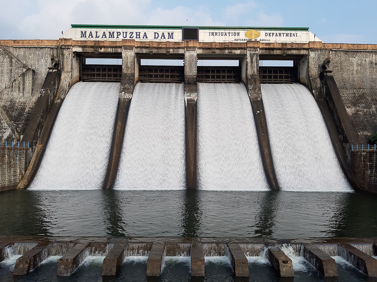
MALAMPUZHA IRRIGATION PROJECT
| Details of Dam Engineers | ||
|---|---|---|
| Chief Engineer | Chief Engineer (Projects I) | |
| Superintending Engineer | Siruvani Project Circle Palakkad | |
| Executive Engineer | Irrigation Division Malampuzha | |
| General | |
|---|---|
| State | Kerala |
| District | Palakkad |
| Taluk/Village | Palakkad, Malampuzha I |
| Latitude | Between 10° 48' and 10° 55' |
| Longitude | Between 76° 39' and 76° 42' |
| River | Malampuzha |
| Year of Completion | 1966 |
| Structural Features of Dam | |
| Type | Straight Gravity Dam with Earthen Saddle |
| Top Width | Masonry 4.87M Earthen ndash; 222.20M |
| Bottom Width | 21.336 M |
| Length | Masonry ndash; 1626.71M Earthen ndash; 222.20M |
| Maximum Height from Lowest Foundation | 38.10 M |
| Slope - Upstream amp Downstream | Masonry 1:8U/S, 0.7:1 0.6:1 D/S |
| Hydrological Features of Dam | |
| Catchment Area | 147.635Km2 |
| Probable Maximum Flood | 360 cumecs |
| Spillway | |
| Location | 110.49M Chainage |
| Type | |
| Total length | 55M |
| Crest level | 110.49M |
| Design capacity of spillway | 367 Cumecs |
| Number, type and sizes of gates | 4 nos. 10.97 x 4.57M |
| Reservoir Features | |
| Top Bank Level | 117.35M |
| Maximum Water Level | 115.06M |
| Full Reservoir Level | 115.06M |
| Minimum Drawdown Level | 91.44M |
| Dead Storage Capacity | 12.40 Mm3 |
| Gross Storage Capacity | 226 Mm3 |
| Free board over F.R.L | 2.29 m |
| Reservoir Area at F.R.L | 22 Km2 |
| Free board over M.W.L | 2.50m |
MANGALAM IRRIGATION PROJECT

| Details of Dam Engineers | ||
|---|---|---|
| Chief Engineer | Chief Engineer (Projects I) | |
| Superintending Engineer | Siruvani Project Circle Palakkad | |
| Executive Engineer | Irrigation Division Malampuzha | |
| General | |
|---|---|
| State | Kerala |
| District | Palakkad |
| Taluk/Village | Alathur, Kizhakkencherry 11 |
| Latitude | 10° 31’ North |
| Longitude | 76° 32’ East |
| River | Cherukunnam Puzha |
| Year of Completion | 1966 |
| Structural Features of the Dam | |
| Type | Gravity type masonry Dam and Earth |
| & | dam of Rockfill Type |
| Top Width | Masonry- 6.25m |
| & | Earth Dam- 7.32m |
| Bottom Width | 17.34m |
| Length | Earthern- 895m. |
| & | Masonry- 162m. |
| Maximum Height | 16.92m. |
| & | Earth work - 0.91 Milliom m 3 |
| Volume Content of Dam Body | Masonry - 0.007 Milliom m3 |
| Slope- upstream & downstream | 2:1 & 2.5:1 |
| Hydrological Features of the Dam | |
| Catchment Area | 48.85 Km2 |
| Probable Maximum Flood | 8650 Cumecs |
| Spillway | |
| Location | Over masonry |
| Type | Ogee type |
| Total length | 162m |
| Crest Level | +76.52m |
| Design Capacity of Spillway | 8650 Cumecs |
| Number, Type and Sizes of Gates | |
| 3 nos -2set; 1 8.69x 1.98 (3 Nos) | |
| & | 18.69 x1.38 (3 nos) |
| Reservoir Features | |
| Top bank Level | 80.95m |
| Maximum water level | +77.88m. |
| Full reservoir level | +77.88m. |
| Minimum drawdown level | +64.00m. |
| Dead storage capacity | 0.15Mm3 |
| Gross storage capacity | 25.344Mm3 |
| Freeboard over F.R.L | & |
| Reservoir Area at F.R.L | 3.96 Sq. m |
| Head Sluice | |
| Spill level | +64 |
SIRUVANI DAM
| General | |
|---|---|
| State | Kerala |
| District | Palakkad |
| Taluk/Village | Sholayar Panchayath |
| Latitude | 10° 58' 36" North |
| Longitude | 76° 38' 32" East |
| River | Siruvani |
| Year of Completion | 1984 |
| Structural Features of the Dam | |
| Type | Masonry straight gravity |
| Top Width | 4.36m |
| Bottom Width | 17.34m |
| Length | 224m. |
| Maximum Height | 57m |
| Volume Content of Dam Body | 1,40,000m3. |
| Slope- Upstream amp Down | Upstream- +829to860 1:10 and from 878 vertica stream Downstream 1:7 |
| Hydrological Features of the Dam | |
| Catchment Area | 22.47 sq. Km. |
| Probable Maximum Flood | 435 m3/sec |
| Spillway | |
| Location | |
| Type | Ogee type |
| Total length | 49.40m |
| Crest level | 878.50m. |
| Design capacity of spillway | 435m3/sec. |
| Number, type and sizes of gates | Nil |
| 5. Reservoir Features | |
| Top bank Level | 883.00m |
| Maximum water level | 881.5m. |
| Full reservoir level | 878.50. |
| Minimum drawdown level | +64.00m. |
| Dead storage capacity | 7.08Mm3 |
| Gross storage capacity | 25.50Mm3 |
| Reservoir Area at F.R.L | 1.636 Sq. Km |
KANHIRAPUZHA IRRIGATION PROJECT

| Details of Dam Engineers | ||
|---|---|---|
| Chief Engineer | Chief Engineer (Projects I) | |
| Superintending Engineer | Siruvani Project Circle Palakkad | |
| Executive Engineer | KPIP Division Kanhirapuzha Division | |
| General | |
|---|---|
| State | Kerala |
| District | Palakkad |
| Taluk/Village | Mannarkkad/ Kanhirapzha |
| Latitude | 58' North |
| Longitude | 72° 32' East |
| River | Kanhirapuzha |
| Year of Completion | 1983 |
| Structural Features of Dam | |
| Type | Earth dam 1896m, Masonry dam 231.60m |
| Top Width | E-6.50m M- 4.30m |
| Bottom Width | E-146.00m M- 28.95m |
| Length | E-1896.40m M-231.60m |
| Maximum Height from bed | 30.78m |
| Level | |
| Volume Content of Dam Body | 1511000 M3 |
| Slope- Upstream | E-1: 2.5 to 1:3.50 M- 10:1 |
| Down stream | 1:2 to 1:2.50 10:6 to 10: 8.5 |
| Hydrological Features of Dam | |
| Catchment Area | 70.00 Sq. Km |
| Probable Maximum Flood | 504.00 cumecs |
| Spillway | |
| Location | Centre portion |
| Type | Ogee type |
| Total length | 36.6 m |
| Crest level | + 92.5 m |
| Design capacity of spillway | 512.50 cumecs |
| Number, type and Sizes of Gates | Vertical lift gate 3x 12.20 x 4.5744 m |
| Reservoir Features | |
| Top of dam | 100.28 m |
| Maximum water level | +97.535 m |
| Full reservoir level | +97.535 m |
| Minimum drawdown level | +77.400m |
| Dead storage capacity | 1.6 Mm3 |
| Gross storage capacity | 70.8274 Mm3 |
| Freeboard over F.R.L | 2.745 m |
| Reservoir Area at F.R.L | 4.65 m |
| Free board over M.W.L | 2.745 m |
KUTTIYADI IRRIGATION PROJECT

| General | |
|---|---|
| State | Kerala |
| District | Kozhikode |
| Taluk/Village | Koyilandy/Badagara |
| Latitude | 11° 36' 45" North |
| Longitude | 75° 49' 27" East |
| River | Kuttiady |
| Year of Completion | 1993 |
| 2. Structural Features of Dam | |
| Type (1) (2) | Main dam gravity dam (Stone masonry) 13Nos. Earth dam |
| Top Width | 11.13 m |
| Bottom Width | 25.40m |
| Maximum Ht from lowest Foundation | 35.36 m |
| 3. Hydrological Features of Dam | |
| Catchment Area | 108. 78. sq.km |
| Probable Maximum Flood | 1071.75 m3/sec |
| Method of Estimating PMF | Ryversquo;s formula |
| 4. Spillway | |
| Location | Latitude- 11° 36' 45" North Longitude- 75° 49' 27" East |
| Type | Ogee type |
| Total length | 48.8 |
| Crest level | 38.44m |
| Design Capacity of Spillway | 1444 m3/sec |
| Number, Type and Sizes of Gates | 4Nos. Radial Shutter 12.2m x 7.62m |
| 5. Reservoir Features | |
| Top bank Level | +46.88m |
| Maximum Water Level | +44.41m |
| Full Reservoir Level | 44.41m |
| Minimum Draw Down Level | +25.52m |
| Dead Storage Capacity | 7.08 Mm3 |
| Gross Storage Capacity | 120.52Mm3 |
| Free board over F.R.L | 2.44m |
| Reservoir Area at F.R.L | 1052 hect. |
| Free board over M.W.L | 2.44m |
| 6. Head Sluice | |
| Sill level | 25.52 m |
WALAYAR IRRIGATION PROJECT

| General | |
|---|---|
| State | Kerala |
| District | Palakkad |
| Taluk/Village | Palakkad / Pudussery East |
| Latitude | 10° 43' and 10° 52' North |
| Longitude | 76° 42' and 76° 50' East |
| River | Walayar River (Tributary of Bharathapuzha) |
| Structural Features of the Dam | |
| Type | Masonry dam flanked by earthen dams |
| Top Width | Masonry 3.6m |
| Bottom Width | 21.60m |
| Length | Masonry 150m, Earth 1329m |
| Maximum Height from bed level | 28.105 m |
| Slope- Upstream amp; Downstream | Earth 2.5:1 Masonry 2:1 |
| Hydrological Features of the Dam | |
| Catchment Area | 106.35Sq. KM |
| Probable Maximum Flood | 396.40Cumecs |
| Method of estimating PMF | Current meter method |
| Spillway | |
| Location | Middle portion |
| Type | Vertical lift type |
| Total length | 42m |
| Crest level | +199.95m |
| Design capacity of spillway | 396.40 Cumecs |
| Number, type and sizes of gates | 3 nos. size 12 x 3 m |
| Reservoir Features | |
| Top bank Level | +205.00m |
| Maximum water level | +203.00m |
| Full reservoir level | +203.00m |
| Minimum drawdown level | +182.575m |
| Dead storage capacity | Nil |
| Gross storage capacity | 18.40Mm3 |
| Freeboard over F.R.L | 2.04m |
| Free board over M.W.L | 2.04m |
| Area of reservoir at F.R.L | 2.59 Sq. Km |
| Head Sluice | |
| Sill level | +182.575m and +188.975m |
| Spill Channel | Natural River |
MEENKARA IRRIGATION PROJECT

| Details of Dam Engineers | ||
|---|---|---|
| Chief Engineer | Chief Engineer (Projects I) | |
| Superintending Engineer | Siruvani Project Circle Palakkad | |
| Executive Engineer | Irrigation Division Chittoor | |
| General | |
|---|---|
| State | Kerala |
| District | Palakkad |
| Taluk/Village | Muthalamada |
| Latitude | 10° 38' North |
| Longitude | 76° 48' East |
| River | Meenkara |
| Year of Completion | 1964 |
| Structural Features of the Dam | |
| Type | Earth dam of zonal type |
| Top Width | 7.0 m |
| Bottom Width | 70.0m. |
| Length | Earthen-964m. Masonry- 30m. |
| Maximum Height | 18.9m. |
| Volume Content of Dam Body | Earth work - 0.91 Million m3 Masonry - 0.007 Million m3 Concrete - 0.00229 Million m3 |
| Slope- Upstream amp; Down stream | U/s slope 2:1,2.5:1,3:1 D/s slope 2:1,2.5:1,3:1 |
| Hydrological Features of the Dam | |
| Catchment Area | 90.65 Km2 |
| Probable Maximum Flood | 472.60 cumecs |
| Spillway | |
| Location | Right end |
| Type | Ogee type |
| Total length | 30m. |
| Crest level | 151.79 m |
| Design Capacity of Spillway | 472.60 Cumecs |
| Number, Type and Sizes of Gates | 2 nos,vertical lift type 12.19*4.57m |
| Reservoir Features | |
| Maximum water level | +156.36m. |
| Full reservoir level | +156.36m. |
| Minimum drawdown level | +143.64m. |
| Dead storage capacity | 1.0M m3 |
| Gross storage capacity | 11.33 Mm3 |
| Freeboard over F.R.L | 2.48m |
| Reservoir Area at F.R.L | 249.50 Ha |
| Free board over M.W.L | 2.44m |
CHULLIYAR DAM
| Details of Dam Engineers | ||
|---|---|---|
| Chief Engineer | Chief Engineer (Projects I) | |
| Superintending Engineer | Siruvani Project Circle Palakkad | |
| Executive Engineer | Irrigation Division Chittoor | |
| General | |
|---|---|
| State | Kerala |
| District | Palakkad |
| Taluk/Village | Palakkad / Pudussery East |
| Latitude | 10° 43' and 10° 52' North |
| Longitude | 76° 42' and 76° 50' East |
| River | Walayar River (Tributary of Bharathapuzha) |
| Structural Features of the Dam | |
| Type | Masonry dam flanked by earthen dams |
| Top Width | Masonry 3.6m |
| Bottom Width | 21.60m |
| Length | Masonry 150m, Earth 1329m |
| Maximum Height from bed level | 28.105 m |
| Slope- Upstream amp; Downstream | Earth 2.5:1 Masonry 2:1 |
| Hydrological Features of the Dam | |
| Catchment Area | 106.35Sq. KM |
| Probable Maximum Flood | 396.40Cumecs |
| Method of estimating PMF | Current meter method |
| Spillway | |
| Location | Middle portion |
| Type | Vertical lift type |
| Total length | 42m |
| Crest level | +199.95m |
| Design capacity of spillway | 396.40 Cumecs |
| Number, type and sizes of gates | 3 nos. size 12 x 3 m |
| Reservoir Features | |
| Top bank Level | +205.00m |
| Maximum water level | +203.00m |
| Full reservoir level | +203.00m |
| Minimum drawdown level | +182.575m |
| Dead storage capacity | Nil |
| Gross storage capacity | 18.40Mm3 |
| Freeboard over F.R.L | 2.04m |
| Free board over M.W.L | 2.04m |
| Area of reservoir at F.R.L | 2.59 Sq. Km |
| Head Sluice | |
| Sill level | +182.575m and +188.975m |
| Spill Channel | Natural River |
POTHUNDY IRRIGATION PROJECT
| Details of Dam Engineers | ||
|---|---|---|
| Chief Engineer | Chief Engineer (Projects I) | |
| Superintending Engineer | Siruvani Project Circle Palakkad | |
| Executive Engineer | Irrigation Division Malampuzha | |
| General | |
|---|---|
| State | Kerala |
| District | Palakkad |
| Taluk/ Village | Chittur |
| Latitude | 10° 32.5' North |
| Longitude | 70° 36.5' E |
| River | Ayilur (Tributary of Bharathapuzha ) |
| Structural Features of the Dam | |
| Type | Homogenous Earth Dam |
| Top width | 7.32 m |
| Bottom width | 133.8 m |
| Length | 1680 m |
| Maximum height from bed level | 32.61 m |
| Slope - upstream amp; downstream | 2:1, 2:1 |
| Hydrological Features of the Dam | |
| Catchment Area | 31 sq.kms |
| Probable Maximum Flood | 680 cumecs |
| Method of estimating PMF | Current Meter Method |
| Spillway | |
| Location | Right Flank of Dam |
| Type | Gravity Type with Ogee Curve |
| Total length | 40 m |
| Crest Level | +104.09 m |
| Design Capacity of Spillway | 682.44 cumecs |
| Number, Type, amp; Size of Gates | 3, (12.19X 4.11), Level shutters |
| Reservoir Features | |
| Top bank level | +110.642 m |
| Maximum water level | +108.204 m |
| Full reservoir level | +108.204 m |
| Minimum draw down level | 91.44 m |
| Dead storage capacity | 7.014 Mm3 |
| Gross storage capacity | 50.914 Mm3 |
| Freeboard over FRL | 2.42 m |
| Area of reservoir at FRL | 2.75 sq.kms |
| 6. Head Sluice | |
| Sillevel | +91.44m |
PAMBA IRRIGATION PROJECT

| General | |
|---|---|
| State | KERALA |
| District | PATHANAMTHITTA |
| Taluk / Village | Ranni Taluk / Vadasserikkara Village |
| Latitude | 9° 20' North |
| Longitude | 76° 53' East |
| River | River Kakkad, tributary of PAMBA |
| Type | A central spillway portion flanked by bulkhead sections on either side. Bulkheads are straight gravity type random rubble masonry dams with coursed rubble facing. Spillway section is made of Random Rubble Masonry in cement mortar with ashlar ogee portion and R.C.C upstream face. |
| Top Width | 5.48 M |
| Bottom Width | 13.25 M |
| Length | 115.22 M |
| Maximum Height from bed level | 16.76 M |
| Slope upstream and down stream | 1.Bulk Head on either sides Upstream face - 1:10 from 18.29m 21.62m and Vertical from 21.64m top Down stream face - 1:1.1 from 18.28m to 21.64m,0.65:1 from 21.64m to 24.69m,0.4 :1 from 24.69M to 30.78m, and vertical from 30.78 to 36.88m |
| 2. Spill way portion | |
| Upstream Face ndash; same as that of bulk head Down Stream face ndash;Ogee profile is based on the model studies conducted at KERI,Peechi. Transition between the bowall and the floor is provided as a stilling basin with a curved floor of radius 6.70M | |
| Hydrological Features of the Dam | |
| Catchment Area | 287 Sq.Km |
| Probable Maximum Flood (PMF) | 1280 cumecs |
| Method of Estimating PMF | By Ryve's formula |
| Spillway | |
| Location | At the centre of the barrage |
| Type | Random Rubble in cement mortar with Ashlar Ogee facing and R.C.C upstream face |
| Total Length | 64.31 M |
| Crest Level | 29.26 M |
| Design Capacity of spill way | 1287 cumecs |
| Number, type and size of gates | 5 nos. Vertical Lift type ndash; size 10.70M x 5.50M |
| Reservoir Features | |
| Top Bank Level | 36.83M |
| Maximum Water Level | 35.35 M |
| Full Reservoir Level | 34.62 M |
| Minimum draw down level | 29.26 M |
| Dead Storage Capacity | |
| Gross storage capacity | 8 Mm3 |
| Free board over F R L | 2.21 M |
| Free board over M W L | 1.48 M |
| Area of Reservoir at F R L | 1.08 Sq.Km |
| 6. Head Sluice | |
| Spill way | 31.09 M |
| Spill Channel | No spill channel |
| Instrumentation | Nil |
PAZHASSI IRRIGATION PROJECT
| Details of Dam Engineers | ||
|---|---|---|
| Chief Engineer | Chief Engineer (Projects I) | |
| Superintending Engineer | Project Circle kannur | |
| Executive Engineer | PYIP Division II Kannur | |
| General | |
|---|---|
| District | KANNUR |
| Taluk / Village | Thalassery |
| Latitude | 11° 5939' 00" North |
| Longitude | 75° 3739' 00" East |
| River | Valapattanam river |
| Structural Features of the Dam | |
| Type | Masonry barrage. |
| Top Width (Bulk Head) | 5.49 M |
| Bottom Width (-do-) | 14.02 M |
| Length | 245 M |
| Maximum Height from bed level | 18.29 M |
| Slope :Upstream | Vertical |
| Down stream | 2:1. |
| Hydrological Features of the Dam | |
| Catchment Area | 640 Sq.Km |
| Probable Maximum Flood (PMF) | 3500 cumecs |
| Method of Estimating PMF | Unit Hydrograph |
| Spillway | |
| Location | Kuiloor |
| Type | Masonry |
| Total Length | 138 M |
| Crest Level | 13.72 M |
| Design Capacity of spill way | 3500 cumecs |
| Number, type and size of gates | 16 nos. Radial (6.1 x 5.18 M size) |
| Reservoir Features | |
| Top Bank Level | 27.52M |
| Maximum Water Level | 27.44 M |
| Full Reservoir Level | 26.52 M |
| Minimum draw down level | 24.66 M |
| Dead Storage Capacity | Nil |
| Gross storage capacity | 97.5 Mm3 |
| Free board over F R L | 1 M |
| Free board over M W L | 1.48 M |
| Area of Reservoir at F R L | 650 Ha |
| Head Sluice | |
| Spill way | 24.66 M |
| Spill Channel | Nil |
| Instrumentation | Electrically operated radial |
PERIYAR VALLEY IRRIGATION PROJECT
| General | |
|---|---|
| State | KERALA |
| District | ERNAKULAM |
| Taluk / Village | Kothamangalam |
| Latitude | 10° 0839' 16" North |
| Longitude | 76° 4039" 00" East |
| River | Periyar |
| Structural Features of the Dam | |
| Type ndash; If more than one type give details of each type | Masonry barrage. |
| Top Width (pillars) | 2.44 m-12 pillars side span, 3.96 m-2 |
| Bottom Width (-do-) | 3.04m-12 pillar side span, 3.96m-2 |
| Length | 210.92 M |
| Height of barrage | 11.79 M |
| Slope- Upstream; Down stream | |
| Hydrological Features of the Dam | |
| Catchments Area | Total 3048 sq.km,Free catchment 938 sq.km. |
| Probable Maximum Flood (PMF) | 7079 cumecs |
| Method of Estimating PMF | |
| Spillway | |
| Location | |
| Type | |
| Total Length | 173.7 M |
| Crest Level | Central span-24.59m, side span-25.81 |
| Design Capacity of spill way | 7370cumecs |
| Number, type and size of gates | 15nos. ventways provided with electrically operated framed steel shutters with vertical lifting arrangements. Size of gates: 3nos. - 9.14*10.36m.12nos - 12.19m*9.14m |
| Reservoir Features | |
| Top Bank Level | 36.43 M |
| Maximum Water Level | 34.95 M |
| Full Reservoir Level | 34.95 M |
| Minimum draw down level | |
| Dead Storage Capacity | |
| Gross storage capacity | 169.79 mm3 |
| Free board over F R L | 1.48 M |
| Free board over M W L | 1.48 M |
| Area of Reservoir at F R L | 16.4 Sq.Km |
| Head Sluice | |
| Spill way | |
| Spill Channel | Nil |
| Instrumentation | Nil |
KARAPPUZHA IRRIGATION PROJECT
| General Features | |
|---|---|
| River Basin | Cauvery |
| Sub River Basin | Kabani |
| District | Wayanad |
| Earthquake Zone | Zone III |
| Survey of India Map Reference | 58 A/2 |
| Nearest Cities | Kalpetta |
| Nearest Airport | Kozhikode & Kannur |
| Nearest Railway Station | Kozhikode |
| Nearest Immediate Project if any | Kabini Reservoir |
| Type of Project | Irrigation |
| Irrigation Benefits | |
| Gross Command Area (GCA) | 6800 Ha |
| Cultivable Command Area (CCA) | 5,600 Ha |
| Annual Irrigation Potential | 8,721 Ha |
| Hydropower Installed Capacity | N/A |
| Annual Quantum of Water Supply (Mm3) | 16.06 Mm3 |
| Details of Tourism Facilities | Karapuzha Mega Tourism Garden & Adventure Park, First Phase opened to public on 21st May 2017 |
| Latitude | 11°37'00" |
| Longitude | 76°10'30" |
| Type of Dam | Homogenous Rolled Earth Fill |
| Length of Dam at Top | 625 m |
| Width of Dam at Top | 7 m |
| Height Above Deepest Foundation | 28 m |
| Volume Content of Dam (Mm3) | N/A |
| Main Spillway Arrangement | |
| Type of Spillway | Ogee |
| No. of Bays | 3 |
| Type of Gate | Radial |
| Size of Gate - | |
| Height (m) | 7 |
| Width (m) | 9.96 |
| Total Spillway Capacity of all Bays (m³/s) | 1220 |
| Gate Hoisting Arrangement | Rope-Drum Type |
| Hoisting Capacity of Single Gate (T) | 22 |
| Energy Dissipation Arrangement | Stilling Basin |
| Auxiliary Spillway Arrangement | |
| Type of Spillway | N/A |
| No. of Bays | N/A |
| Type of Gate | N/A |
| Size of Gate - | N/A |
| Height (m) | N/A |
| Width (m) | N/A |
| Total Spillway Capacity of all Bays (m³/s) | N/A |
| Gate Hoisting Arrangement | N/A |
| Hoisting Capacity of Single Gate (T) | N/A |
| Energy Dissipation Arrangement | N/A |
| Details of Outlet Works | N/A |
| Reservoir features | |
| Catchment Area at Dam Site (km²) | 62 |
| Maximum Water Level (m) | 764 |
| Full Reservoir Level (m) | 763 |
| Minimum Draw Down Level (m) | 749 |
| Dead Storage Level (m) | 749 |
| Live Storage Capacity (Mm³) | 72 |
| Gross Storage Capacity at FRL (Mm³) | 76.5 |
| Reservoir Spread Area at FRL (km²) | 8.55 |
| Date of Starting the Construction | 1978 |
| Date of completion | 11-02-2005 |
| Date of first Impoundment | N/A |
| Design Flood | |
| Original design Flood ( m 3/sec) | 969 |
| Revised flood ( m 3/sec) | 1326 |
MOOLATHARA REGULATOR (CHITTURPUZHA PROJECT)
| General Features | |
|---|---|
| River Basin | Bharathapuzha |
| Sub River Basin | Bharathapuzha |
| District | Palakkad |
| Earthquake Zone | III |
| Survey of India Map Reference | 58B / 14, 58B / 10, 58B/11 |
| Nearest City | Palakkad |
| Nearest Airport | Coimbatore |
| Nearest Railway Station | Palakkad Division |
| Nearest Immediate Project (if any) | Tirumurthi, Aliyar |
| Type of Project | Irrigation |
| Irrigation Benefits | |
| Gross Command Area (GCA) (Ha) | 20,440 |
| Cultivable Command Area (CCA) (Ha) | 16,940 |
| Annual Irrigation Potential (Ha) | 20,440 |
| Hydropower Benefits Installed Capacity | N/A |
| Annual Quantum of Water Supply (m³) | N/A |
| Details of Tourism Facilities | N/A |
| Latitude | 10° 40' 30" |
| Longitude | 76° 46' 00" |
| Type of Dam | Masonry |
| Length of Dam at Top (m) | 144.84 |
| Width of Dam at Top (m) | N/A |
| Height above Deepest Foundation (m) | 7.2 |
| Volume Content of Dam (m³) | N/A |
| Main Spillway Arrangement | |
| Type of Spillway | Ogee |
| Number of Bays | 13 |
| Type of Gate | Vertical Lift |
| Size of Gate | |
| Height (m) | 9.14 (7 Nos), 6.10 (6 Nos) |
| Width (m) | 5.18 |
| Total Spillway Capacity of all Bays (m³/s) | 2297 |
| Gate Hoisting Arrangement | Chain and Sprocket Type |
| Hoisting Capacity of Single Gate (T) | 10 |
| Energy Dissipation Arrangement | Stilling Basin |
| Details of Outlet Works | N/A |
| Reservoir features | |
| Catchment Area at Dam Site (km²) | 770.63 |
| Maximum Water Level (m) | 184.95 |
| Full Reservoir Level (m) | 184.7 |
| Minimum Draw Down Level (m) | 181.55 |
| Dead Storage Level (m) | 181.55 |
| Live Storage Capacity (Mm³) | 0.538 |
| Gross Storage Capacity at FRL (Mm³) | 0.538 |
| Reservoir Spread Area at FRL (km²) | 0.36 |
| Date of Starting Construction | 05-16-1963 |
| Date of Completion | 05-25-1972 |
| Date of First Impoundment | 1972 |
| Design Flood | |
| Original design Flood ( m 3/sec) | 3080 |
| Revised flood ( m 3/sec) | 4429 |