


Chulliyar Irrigation Project
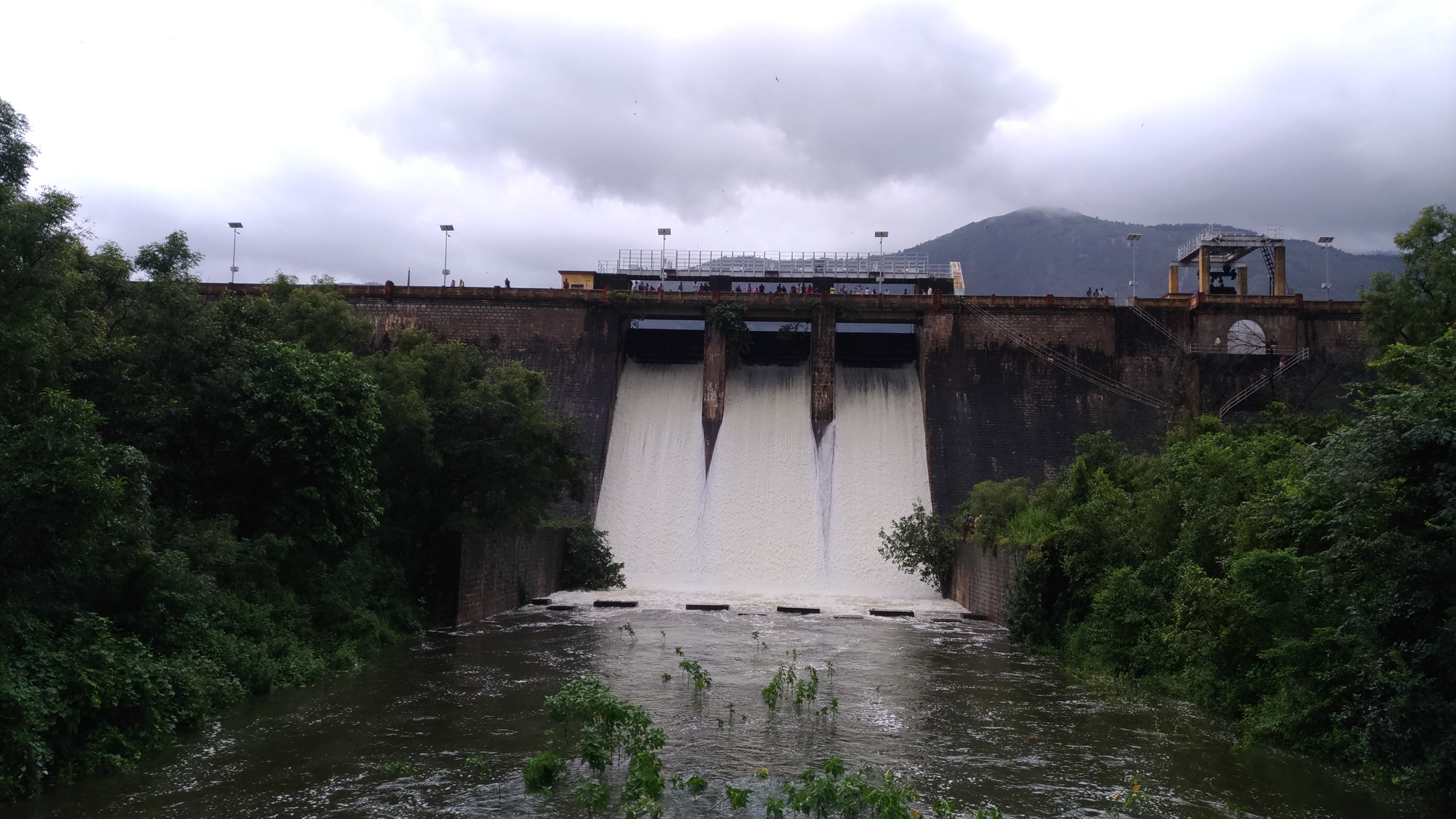
Chulliyar Dam is built across Gayathri River which is a tributary of Bharathapuzha. This is stage II of Gayathri project and was taken up in 1961. The project was partially commissioned in 1966 and completed in the year 1970. It has gross storage capacity of 13.70 Million cubic meter at the Full Reservoir Level (F.R.L.) of +154.08 m. Canal sluice is located at a level of +136.55 m. Total catchment area of the project is about 27.80 sq. km. The Dam is located in Muthalamada Panchayath of Chittur Thalik and the Legislative Assembly Constituency is Nemmara at Latitude 100 -36’ North and Longitude 760-46’ East. Chulliyar Dam is a composit Dam ghaving masonary Dam of length 555 M laying in East – West direction, and flanked by earthen Dam and its west end in perpendicular direction which extent southwards for 700 m. also there is a saddle dam of length 500 M at the south side of earthen dam.
The reservoir has a link canal with Meenkara reservoir which is used to divert water from Meenkara in case it gets filled up. Palakappandy link canal joins the reservoir at its South- West side and this canal carries water diverted from Palakppandy waterfalls.
The canal network of Chulliyar Project has total length of about 36.52 km. Out of this 10.60 km is main canal which is continuation of Left Bank Main canal of Meenkara project (Gayathri Stage I) and remaining length are branches and distributaries. Total ayacut of the project comes to an extent of 2430 Ha and is spread over Muthalamada, Kollengode, Elavanchery, Nemmara and Pallassana Grama Panchayaths. Major crops cultivated in the ayacut is Paddy.
| Details of Dam Engineers | ||
|---|---|---|
| Chief Engineer | Chief Engineer (Projects I) | |
| Superintending Engineer | Siruvani Project Circle Palakkad | |
| Executive Engineer | Irrigation Division Chittoor | |
| General | |
|---|---|
| State | Kerala |
| District | Palakkad |
| Taluk/Village | Chittur / Muthalamada |
| Latitude | 10° 36'' North |
| Longitude | 76° 36' East |
| River | Gayathri River (Tributary of Bharathapuzha) |
| Structural Features of the Dam | |
| Type | Masonry dam flanked by earthen dams |
| Top Width | Masonry 4.85 m |
| Bottom Width | 21.60 m |
| Length | Masonry 555m, Earthen dam 700m, Saddle dam 500m |
| Maximum Height from bed level | 30.50 m |
| Slope- Upstream amp; Downstream | Earth 2.5:1 Masonry 2:1 |
| Hydrological Features of the Dam | |
| Catchment Area | 27.80 Sq. KM |
| Probable Maximum Flood | 223.70 Cumecs |
| Method of estimating PMF | Current meter method |
| Spillway | |
| Location | Middle portion |
| Type | Ogee |
| Total length | 30 m |
| Crest level | +199.95m |
| Design capacity of spillway | 223.70 Cumecs |
| Number, type and sizes of gates | 3 nos. Vertical lift type, size 7.60 x 3.05 m |
| Reservoir Features | |
| Top bank Level | + 155.60 m |
| Maximum water level | +154.08 m |
| Full reservoir level | + 154.08m |
| Minimum drawdown level | +136.55 m |
| Dead storage capacity | 1 Mm3 |
| Gross storage capacity | 13.70 Mm3 |
| Freeboard over F.R.L | 1.52 m |
| Free board over M.W.L | 1.52 m |
| Area of reservoir at F.R.L | 1.65 Sq. Km |
| Head Sluice | |
| Sill level | +136.55 m |
| Spill Channel | Natural River |