നെയ്യാർ ഡാം

| അണക്കെട്ട് എഞ്ചിനീയർമാരുടെ വിശദാംശങ്ങൾ | ||
|---|---|---|
| ചീഫ് എഞ്ചിനീയർ | ചീഫ് എഞ്ചിനീയർ (Projects II) | |
| എക്സിക്യൂട്ടീവ് എഞ്ചിനീയർ | വൻകിട ജലസേചന വിഭാഗം, തിരുവനന്തപുരം | |
| അസിസ്റ്റന്റ് എക്സിക്യൂട്ടീവ് എഞ്ചിനീയർ | നെയ്യാർ ജലസേചന പദ്ധതി ഉപ വിഭാഗം | |
| അസിസ്റ്റന്റ് എഞ്ചിനീയർ | നെയ്യാർ ഡാം സെക്ഷൻ | |
| പൊതു വിവരങ്ങൾ | |
|---|---|
| സംസ്ഥാനം | കേരളം |
| ജില്ല | തിരുവനന്തപുരം |
| താലൂക്ക്/വില്ലേജ് | നെയ്യാറ്റിൻകര |
| അക്ഷാംശം | 80 32’ വടക്ക് |
| രേഖാംശം | 770 09’ കിഴക്ക് |
| നദി | നെയ്യാർ |
| ഡാമിന്റെ ഘടനാപരമായ സവിശേഷതകൾ | |
| ടൈപ്പ് സ്ട്രെയിറ്റ് ഗ്രാവിറ്റി ടൈപ്പ്- മേസൺറി | അണക്കെട്ട് |
| മുകളിലത്തെ വീതി | 7.54 മീ. |
| താഴത്തെ വീതി | 30.02 മീ. |
| നീളം | 295 മീ |
| തറ നിരപ്പിൽ നിന്നുളള പരമാവധി ഉയരം | 56 മീ |
| ചരിവ്; അപ് സ്ട്രീം എഎംപി; നിന്നും ഡൗൺ സ്ട്രീം | |
| അണക്കെട്ടിന്റെ ജലശാസ്ത്ര സവിശേഷതകൾ | |
| വൃഷ്ടി പ്രദേശം | 140 ച.കി.മീ |
| സാധ്യമായ പരമാവധി വെള്ളപ്പൊക്കം | 809.4 ക്യുമെക്കുകൾ |
| സാധ്യമായ പരമാവധി വെള്ളപ്പൊക്കം കണക്കാക്കുന്ന രീതി | |
| സ്പിൽവേ | |
| സ്ഥാനം | അണകെട്ടിന്റെ നടുവിലുള്ള കൊത്തുപണി |
| തരം | ഓഗി |
| ആകെ നീളം | 34.60 മീ. |
| ക്രസ്റ്റ് ലെവൽl | 79.55 മീ |
| ഡിസൈൻ കപ്പാസിറ്റി ഓഫ് സ്പിൽവേ | 809.4 ക്യുമെക്സ് |
| ഗയ്റ്റുകളുടെ എണ്ണം, തരം, വലുപ്പങ്ങൾ | 4 എണ്ണം, റേഡിയൽ, 8.69 X 5.18 മീ |
| അണക്കെട്ടിന്റെ സവിശേഷതകൾ | |
| ടോപ്പ് ബാങ്ക് ലെവൽ | 85.645 മീ |
| മാക്സിമം വാട്ടർ ലെവൽ | 84.75 മീ |
| ഫുൾ റിസർവോയർ ലെവൽ | 84.75 മീ. |
| പരമാവധി ജലഉപയോഗ യോഗ്യ ലെവൽ | 65.00 മീ |
| ഡെഡ് സ്റ്റോറേജ് കപ്പാസിറ്റി | 10.52 മില്യൺ മീറ്റർ |
| പരമാവധി ഉയർന്ന ജലസംഭരണ ശേഷി | 106.25 മില്യൺ മീറ്റർ3 |
| ഫ്രീബോർഡ് ഓവർ എഫ്.ആർ.എൽ | |
| ഫ്രീബോർഡ് ഓവർ എം.ഡബ്ല്യു.എൽ | |
| അണക്കെട്ടിന്റെ വിസ്തീർണ്ണം എഫ്.ആർ.എൽ | |
| ഹെഡ് സ്ലൂയിസ് | |
| സിൽ ലെവൽ | ഇടത് ബാങ്ക് കനാൽ +59.70 മീ. വലതു ബാങ്ക് കനാൽ +56.65 മീ |
കല്ലട ജലസേചന പദ്ധതി
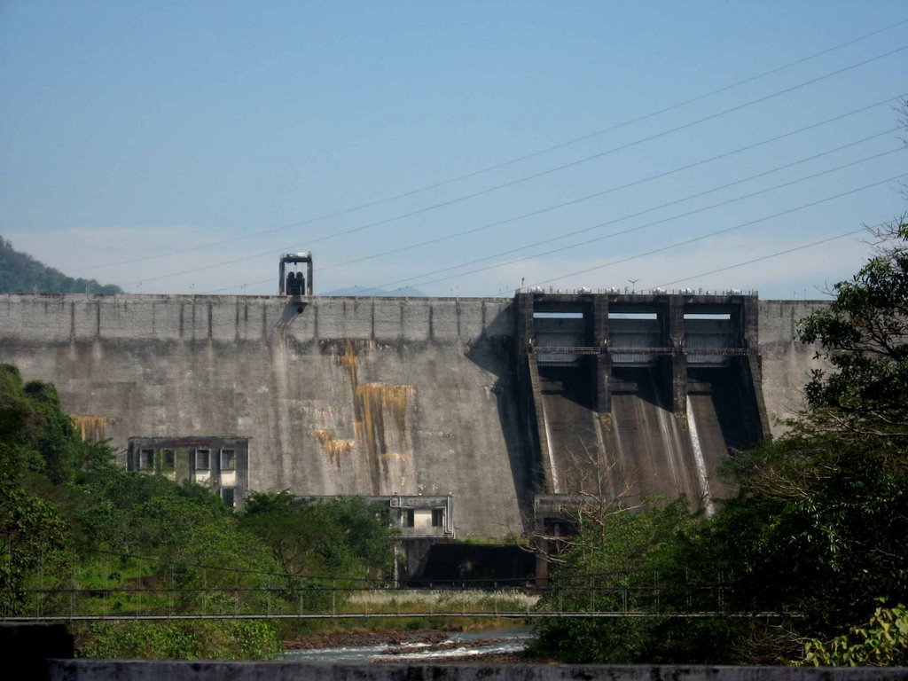
| അണക്കെട്ട് എഞ്ചിനീയർമാരുടെ വിശദാംശങ്ങൾ | ||
|---|---|---|
| ചീഫ് എഞ്ചിനീയർ | ചീഫ് എഞ്ചിനീയർ (Projects II) | |
| എക്സിക്യൂട്ടീവ് എഞ്ചിനീയർ | കല്ലട ജലസേചന പദ്ധതി വലത് ബാങ്ക് വിഭാഗം, കൊട്ടാരക്കര | |
| അസിസ്റ്റന്റ് എക്സിക്യൂട്ടീവ് എഞ്ചിനീയർ | കല്ലട ജലസേചന പദ്ധതി വലത് ബാങ്ക് ഉപ വിഭാഗം നം.2, തെന്മല | |
| അസിസ്റ്റന്റ് എഞ്ചിനീയർ | കല്ലട ജലസേചന പദ്ധതി വലത് ബാങ്ക് സെക്ഷൻ നം.3/2, തെന്മല | |
| പൊതു വിവരങ്ങൾ | |
|---|---|
| സംസ്ഥാനം | കേരളം |
| ജില്ല | കൊല്ലം |
| നദി | കല്ലട |
| അക്ഷാംശം | 77°04'20" വടക്ക് |
| രേഖാംശം | 8°5°07'00" കിഴക്ക് |
| അണക്കെട്ടിന്റെ ജലശാസ്ത്രം | |
| വാർഷിക മഴ | 305cms |
| വൃഷ്ടി പ്രദേശം of Reservoir | 549 ച.കി.മീ |
| Reservoir | |
| അണക്കെട്ടിന്റെ പേര് | കല്ലട (പരപ്പാർ) |
| നിർമ്മാണം ആരംഭിച്ചത് | 1972 |
| നിർമ്മാണം പൂർത്തീകരിച്ചത് | 1986 മെയ് മാസം |
| അണക്കെട്ടിന്റെ തരം | മേസൺറി സ്ട്രൈറ്റ് ഗ്രാവിറ്റി വിത്ത് സ്പിൽവേ |
| അണക്കെട്ടിന്റെ നീളം | 335 മീ |
| ഓവർഫ്ലോ വിഭാഗത്തിന്റെ ദൈർഘ്യം | 42 മീ |
| ഓവർഫ്ലോ അല്ലാത്ത വിഭാഗത്തിന്റെ ദൈർഘ്യം | 393 മീ. |
| പരമാവധി ഉയരം | |
| ആഴമേറിയ അടിത്തറ | 85.35 മീ. |
| അണക്കെട്ടിന്റെ മുകളിലെ വീതി | 7.62 മീ. |
| അണക്കെട്ടിന്റെ മുകൾഭാഗം (റോഡ്വേ) | +118.87 മീ |
| ടോപ് ലെവൽ ഓഫ് പാരപ്പെറ്റ് | +119.87മീ |
| ജലസംഭരണിയുടെ പരമാവധി നിരപ്പ് | +115.82മീ |
| മാക്സിമം വാട്ടർ ലെവൽ | +116.77 മീ |
| താഴ്ന്ന ജലനിരപ്പ് | +70.25 മീ |
| അടിഭാഗത്തെ ജലനിരപ്പ് | +69.65 മീ. |
| ആകെ ജല സംഭരണം അറ്റ് എഫ്ആർഎൽ | 524 മില്യൺമീ3 |
| ആകെ ജല സംഭരണം അറ്റ് എംഡബ്ലുഎൽ | 536 മില്യൺ മീ3 |
| നിലവിലെ സംഭരണം അറ്റ് എഫ്ആർഎൽ | 507 മില്യൺ മീ3 |
| ഡെഡ് സ്റ്റോറേജ് കപ്പാസിറ്റി | 17.00 മില്യൺ മീ 3 |
| വെള്ളം വ്യാപിക്കുന്ന സ്ഥലം അറ്റ് എഫ്ആർഎൽ | 23 സ്ക്വയർ കിലോമീറ്റർ. |
| തരം | ഗേറ്റഡ് ഓഗീ ടൈപ്പ് |
| ക്രെസ്റ്റ് ഗേറ്റുകളുടെ തരവും വലുപ്പവും | റേഡിയൽ 12.19 മീ അക്യൂട്ട് 9.14 മീ. |
| ക്രെസ്റ്റ് ഗേറ്റുകളുടെ എണ്ണം | 3 എണ്ണം |
| ക്രസ്റ്റ് ലെവൽ | +106.68 മീ |
| ഹെഡ് ഓവർ ക്രെസ്റ്റ്span> | 9.14 മീ |
| ഡിസൈൻ ഡിസ്ചാർജ് | 2830 ക്യുമെക്സ് |
| താഴ്ന്ന നിലയിലുള്ള ഔട്ട് ലെറ്റുകളുടെ ശേഷി | 3.75 മീറ്റർ വ്യാസമുള്ള ചാലകം, സിൽ ലെവൽ + 70.25 മീ. എഎംപി; ഡിസ്ചാർജ് ശേഷി 60 ക്യുമിക്കുകൾ |
| ഗേറ്റുകളില്ലാത്ത ജലനിർഗ്ഗമനമാർഗ്ഗം | |
| സ്ഥാനം | മേസൺറി ഡാമിന്റെ വലത് വശം |
| നീളം | 56.00 മീ |
| ക്രസ്റ്റ് ലെവൽ | +116.73 മീ. |
| ഡിസൈൻ ഡിസ്ചാർജ് 689 മീ3/ സെക്കന്റ് | |
| തരം | ലേബിരിന്ത് വിയർ |
| ഗേറ്റുകൾ | ഗേറ്റുകൾ ഇല്ല, ഫ്രീഫ്ലോ |
| സാഡിൽ ഡാം | |
| നീളം | 225.70മീ. |
| പരമാവധി ഉയരം | 12.51മീ |
| പിക്ക്-അപ്പ് വെയർ | |
| നദിയുടെ സ്ലൂയിസ് | 1 എണ്ണം. (2.44 വലിപ്പം നിശിതം; 1.83 മീ |
| വിയറിന്റെ നീളം | 120.69 മീ. |
| ക്രസ്റ്റ് ലെവൽspan> | +63.09 മീ. |
| ഏറ്റവും ആഴത്തിലുള്ള ലെവൽ | +57.50മീ |
| വിയറിന് മുകളിൽ റോഡിന്റെ വീതി | 4.27മീ |
| സ്പാനിന്റെ എണ്ണം | 7 |
| പരമാവധി അപ്സ്ട്രീം വെള്ളപ്പൊക്ക നില | +68.45 മീ. |
| പരമാവധി ഡൗൺസ്ട്രീം വെള്ളപ്പൊക്ക നില | +65.84 മീ. |
മലങ്കര അണക്കെട്ട്
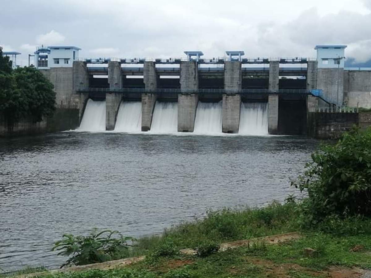
| അണക്കെട്ട് എഞ്ചിനീയർമാരുടെ വിശദാംശങ്ങൾ | ||
|---|---|---|
| ചീഫ് എഞ്ചിനീയർ | ചീഫ് എഞ്ചിനീയർ (Projects II) | |
| എക്സിക്യൂട്ടീവ് എഞ്ചിനീയർ | മൂവാറ്റുപുഴ വാലി ജലസേചന പദ്ധതി വിഭാഗം നം-3, മൂവാറ്റുപുഴ | |
| അസിസ്റ്റന്റ് എക്സിക്യൂട്ടീവ് എഞ്ചിനീയർ | മൂവാറ്റുപുഴ വാലി ജലസേചന പദ്ധതി ഉപ വിഭാഗം നം-1, മുട്ടം | |
| അസിസ്റ്റന്റ് എഞ്ചിനീയർ | മൂവാറ്റുപുഴ വാലി ജലസേചന പദ്ധതി സെക്ഷൻ 2/1, മുട്ടം | |
| പൊതു വിവരങ്ങൾ | |
|---|---|
| സംസ്ഥാനം | കേരളം |
| ജില്ല | ഇടുക്കി |
| താലൂക്ക്/വില്ലേജ് | തൊടുപുഴ, മുട്ടം |
| അക്ഷാംശം | 90 37’ നും 100 04’ നും ഇടയിൽ വടക്ക് |
| രേഖാംശം | betw760 26’ നും 760 49’ നും ഇടയിൽ കിഴക്ക് |
| നദി | തൊടുപുഴ (മൂവാറ്റുപുഴയുടെ കൈവഴി) |
| പൂർത്തീകരിച്ച വർഷം | 1994 |
| ഡാമിന്റെ ഘടനാപരമായ സവിശേഷതകൾ | |
| തരം | മേസൺറി കൊണ്ട് നിർമ്മിച്ച നേരായ ഗുരുത്വാകർഷണ പ്രകാരമുള്ള അണക്കെട്ട് Earthen |
| മുകളിലത്തെ വീതി | മേസൺറി 5.00 മീ, എർതേൺ; 6.90 മീ |
| താഴത്തെ വീതി | 16.7 മീ |
| നീളം | മേസൺറി 254 മീ, എർതേൺ 206 മീ |
| തറ നിരപ്പിൽ നിന്നുളള പരമാവധി ഉയരം | മേസൺറി 23 മീ, എർതേൺ 12.00 മീ |
| ചരിവ്; അപ് സ്ട്രീം എഎംപി; നിന്നും ഡൗൺ സ്ട്രീം | |
| അണക്കെട്ടിന്റെ ജലശാസ്ത്ര സവിശേഷതകൾ | |
| വൃഷ്ടി പ്രദേശം | 153.5 കി.മീ2 |
| സാധ്യമായ പരമാവധി വെള്ളപ്പൊക്കം | 1444.32 ക്യുമെക്സ് |
| സ്പിൽവേ | |
| സ്ഥാനം | |
| തരം | ഓഗീ വിത്ത് റേഡിയൽ ഗേറ്റ് |
| ആകെ നീളം | 62.1 മീ |
| ക്രസ്റ്റ് ലെവൽ | +36.900 മീ |
| ഡിസൈൻ കപ്പാസിറ്റി ഓഫ് സ്പിൽവേ | 1442.32 ക്യുമെക്സ് |
| ഗയ്റ്റുകളുടെ എണ്ണം, തരം, വലുപ്പങ്ങൾ | 6 എണ്ണം 7.6 x 4.6 മീ |
| അണക്കെട്ടിന്റെ സവിശേഷതകൾ | |
| മാക്സിമം വാട്ടർ ലെവൽ | +43.00 മീ. |
| ഫുൾ റിസർവോയർ ലെവൽ | +42.00 മീ. |
| ഏറ്റവും കുറഞ്ഞ ജലഉപയോഗ യോഗ്യ ലെവൽ | +39.00മീ. |
| പരമാവധി ഉപയോഗ യോഗ്യമല്ലാത്ത ജലസംഭരണ ശേഷി | 27.00 മില്യൺ മീറ്റർ3 |
| പരമാവധി ഉയർന്ന ജലസംഭരണ ശേഷി | 38 മില്യൺ മീറ്റർ3 |
| ഫ്രീബോർഡ് ഓവർ എഫ്.ആർ.എൽ | 3 |
ചിമോണി ജലസേചന പദ്ധതി
തൃശൂർ ജില്ലയിലെ കരുവന്നൂർ പുഴയുടെ കൈവഴിയായ ചിമ്മിനിപ്പുഴയിലാണ് ചിമ്മിനി അണക്കെട്ട് നിർമ്മിച്ചിരിക്കുന്നത്. 13000 ഹെക്ടറിലെ മൊത്തത്തിലുള്ള കൃഷിക്ക് ജലസേചനം നൽകുന്നതാണ് ഈ പദ്ധതി. ജലസേചന ആനുകൂല്യത്തിന് പുറമെ വള്ളിവട്ടം-ചേറ്റുവ മേഖലയിലെ 5600 ഹെക്ടർ സ്ഥലത്തെ ഉപ്പുവെള്ളം കയറുന്നതിൽ നിന്ന് സംരക്ഷിക്കാനും കരുവന്നൂർ തടത്തിലെ വെള്ളപ്പൊക്കം കുറയ്ക്കുന്നതിനും പദ്ധതി പ്രയോജനപ്പെടുത്തുന്നു തൃശ്ശൂരിൽ നിന്ന് 38.00 കിലോമീറ്റർ കിഴക്കായാണ് ചിമ്മിനി അണക്കെട്ടും റിസർവോയറും സ്ഥിതി ചെയ്യുന്നത്. ചിമ്മിനി ഡാമിൽ നിന്ന് 29 കിലോമീറ്റർ അകലെയാണ് ഏറ്റവും അടുത്തുള്ള റെയിൽവേ സ്റ്റേഷൻ പുതുക്കാട് സ്ഥിതിചെയ്യുന്നത്. തൃശൂർ ജില്ലയിലെ എച്ചിപ്പാറയിൽ കരുവന്നൂർ പുഴയുടെ കൈവഴിയായ ചിമ്മിനി പുഴക്ക് കുറുകെ ചിമ്മിനി അണക്കെട്ട്, 13000 ഹെക്ടർ നെൽവയലുകൾക്ക് ജലസേചനം നടത്താനും കോൾ നിലങ്ങളിൽ രണ്ട് വിളകളും ഒറ്റവിളയും സാധ്യമാക്കാനുമുള്ള പദ്ധതിയാണ്. ഈ പദ്ധതിയിൽ കനാൽ സംവിധാനമില്ലാത്തതിനാൽ, റിസർവോയറിൽ നിന്നുള്ള നിയന്ത്രിത ഒഴുക്ക് നദിയിലേക്ക് ഒഴുക്കിവിടുകയും വിവിധ സ്ഥലങ്ങളിൽ നിർമ്മിച്ച റെഗുലേറ്ററുകൾ ഉപയോഗിച്ച് വയലുകളിലേക്ക് തിരിച്ചുവിടുകയും ചെയ്യുന്നു. റിസർവോയറിന്റെ സംഭരണശേഷി 151.55Mm3 ഉം ജലവ്യാപന വിസ്തീർണ്ണം 10.10 Km2 ഉം ആണ്. പദ്ധതി പ്രദേശം 10°20' & 10°35'N അക്ഷാംശത്തിനും 76°06' & 76°30'E രേഖാംശത്തിനും ഇടയിലാണ്. ഈ പദ്ധതി 1996-ൽ പൂർത്തീകരിച്ചു. കോമ്പോസിറ്റ് ഡാം ആയ ചിമ്മിനി ഡാമിന്റെ മേസൺറി അണക്കെട്ടിൻ്റെ നീളം 495 മീറ്ററും എർത്ത് ഡാമിൻ്റെ നീളം 686.50 മീറ്ററുമാണ്. ഈ പദ്ധതിയിലൂടെ കോൾ പാടങ്ങളിലെ 11000 ഹെക്ടർ നെൽവയലുകളിൽ പുഞ്ചയ്ക്ക് വെള്ളവും ചേറ്റുവായ്, വള്ളിവട്ടം, ബ്രഹ്മകുളം പ്രദേശങ്ങളിലെ 5400 ഹെക്ടർ നെൽപ്പാടങ്ങൾക്ക് പുറമെ 6200 ഹെക്ടർ കോൾ പാടങ്ങളിൽ അധിക മുണ്ടകൻ വിളയ്ക്കും ജലം ലഭിക്കും. ഇതിനു പുറമെ വെള്ളപ്പൊക്ക നിയന്ത്രണവും പദ്ധതിയുടെ ഒരു അധിക നേട്ടമാണ്.

| Details of Dam Engineers | ||
|---|---|---|
| Chief Engineer | Chief Engineer (Projects II) | |
| Executive Engineer | Irrigation Division, Thrissur | |
| Assistant Executive Engineer | Chimoni Dam Project Sub Division, Echippara | |
| Assistant Engineer | Assistant Engineer, Chimoni dam Project Section No. 1, Echippara | |
| General | |
|---|---|
| സംസ്ഥാനം | കേരളം |
| ജില്ല | Thrissur |
| താലൂക്ക്/വില്ലേജ് | Mukundapuram / Varandarappilly |
| അക്ഷാംശം | 10°20' & 10°35" വടക്ക് |
| രേഖാംശം | 76°06' & 76°30" കിഴക്ക് |
| നദി | ചിമ്മിനിപ്പുഴ (കരുവന്നൂർ പുഴയുടെ കൈവഴി) |
| ഡാമിന്റെ ഘടനാപരമായ സവിശേഷതകൾ | |
| ഘടന | Masonry Dam Earth Dam |
| മുകളിലത്തെ വീതി | 6.00M |
| താഴത്തെ വീതി | 7.20M |
| Length | 524.84M 686.50M |
| Maximum Height from Bed Level | 52.82M 29.97M |
| Slope; Upstream Amp; Down Stream U/S 1H to 10v upto + 72.50m 3H to 1v Vertical upto +81.20m; D/S; 0.85H to 1v upto + 50.00m 0.80H to 1v upto + 60.00m 2.5H to 1v 0.75H to 1v upto + 75.00m | |
| അണക്കെട്ടിന്റെ ജലശാസ്ത്ര സവിശേഷതകൾ | |
| വൃഷ്ടി പ്രദേശം | 72.13 KM2 |
| Probable Maximum Flood | 1680 ക്യുമെക്സ് |
| സ്പിൽവേ | |
| സ്ഥാനം | |
| Type | Ogee overflow with radial crest gate |
| Total length | +47.50M |
| ക്രസ്റ്റ് ലെവൽ | +72.20M |
| ഡിസൈൻ കപ്പാസിറ്റി ഓഫ് സ്പിൽവേ | 1680ക്യുമെക്സ് |
| ഗയ്റ്റുകളുടെ എണ്ണം, തരം, വലുപ്പങ്ങൾ | 4 Nos. Radial crest gate ,10 x 7.5m each |
| അണക്കെട്ടിന്റെ സവിശേഷതകൾ | |
| Top bank level | +81.20M |
| മാക്സിമം വാട്ടർ ലെവൽ | +79.70M |
| ഫുൾ റിസർവോയർ ലെവൽ | +40.00M |
| Minimum draw down level | 6.75Mm3 |
| ഡെഡ് സ്റ്റോറേജ് കപ്പാസിറ്റി | 6.75Mm3 |
| Gross Storage capacity | 179.39Mm3 |
| Freeboard over F.R.L | 1.50M |
| Freeboard over M.W.L | 1.50M |
| Area of reservoir at F.R.L | 10.10 Sq. KM |
| Head Sluice | |
| Sill level | +40.00M |
PEECHI IRRIGATION PROJECT
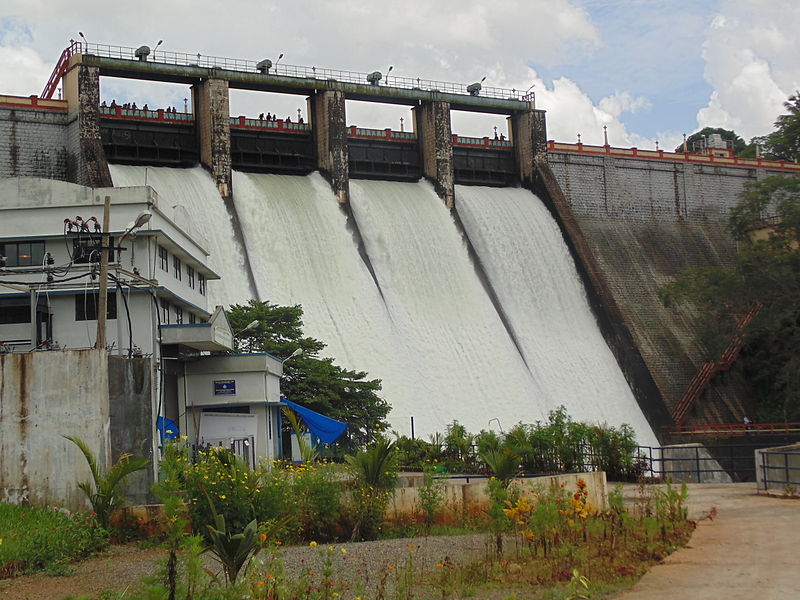
| പൊതു വിവരങ്ങൾ | |
|---|---|
| സംസ്ഥാനം | കേരളം |
| ജില്ല | Thrissur |
| താലൂക്ക്/വില്ലേജ് | Thrissur/ Peechi |
| അക്ഷാംശം | 10° 26' N |
| രേഖാംശം | 76° 24' E |
| നദി | Manali |
| പൂർത്തീകരിച്ച വർഷം | 1958 |
| ഡാമിന്റെ ഘടനാപരമായ സവിശേഷതകൾ | |
| Type -IF more than one type give | Straight, Gravity Rubble Masonry |
| Details of each type | |
| Top Width | |
| 4.27m | |
| താഴത്തെ വീതി | 34.45m |
| Length | 213.36m |
| Maximum Height | 40.85m |
| ചരിവ്; അപ് സ്ട്രീം എഎംപി; നിന്നും ഡൗൺ സ്ട്രീം | 1in.18m amp; 1in 0.65m |
| അണക്കെട്ടിന്റെ ജലശാസ്ത്ര സവിശേഷതകൾ | |
| വൃഷ്ടി പ്രദേശം | 18615.50 Ha |
| സാധ്യമായ പരമാവധി വെള്ളപ്പൊക്കം | 368.119 ക്യുമെക്സ് |
| സ്പിൽവേ | |
| സ്ഥാനം | |
| Type | Ogee overflow |
| Total length | 40.20m |
| ക്രസ്റ്റ് ലെവൽ | +76.20m |
| ഡിസൈൻ കപ്പാസിറ്റി ഓഫ് സ്പിൽവേ | 368.119 ക്യുമെക്സ് |
| ഗയ്റ്റുകളുടെ എണ്ണം, തരം, വലുപ്പങ്ങൾ | 4 nos - Straight 10.05 x 3.05 m |
| അണക്കെട്ടിന്റെ സവിശേഷതകൾ | |
| Top bank Level | 80.47m |
| മാക്സിമം വാട്ടർ ലെവൽ | +79.25m. |
| ഫുൾ റിസർവോയർ ലെവൽ | +79.25m. |
| Minimum drawdown level | +53.34m. |
| ഡെഡ് സ്റ്റോറേജ് കപ്പാസിറ്റി | 2.266 Mm3 |
| Gross storage capacity | 110.436Mm3 |
| Freeboard over F.R.L | Nil |
| Reservoir Area at F.R.L | 12.95 Sq..km |
| Head Sluice | |
| Spill level | 55.78m |
വാഴാനി ജലസേചന പദ്ധതി
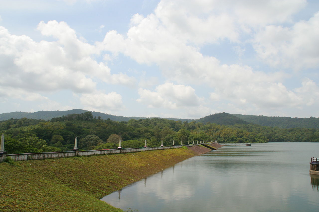
| അണക്കെട്ട് എഞ്ചിനീയർമാരുടെ വിശദാംശങ്ങൾ | ||
|---|---|---|
| ചീഫ് എഞ്ചിനീയർ | ചീഫ് എഞ്ചിനീയർ(Projects II) | |
| എക്സിക്യുട്ടീവ് എഞ്ചിനീയർ | ഇറിഗേഷൻ ഡിവിഷൻ, തൃശ്ശൂർ | |
| അസിസ്റ്റന്റ് എക്സിക്യുട്ടീവ് എഞ്ചിനീയർ | അസിസ്റ്റന്റ് എക്സിക്യുട്ടീവ് എഞ്ചിനീയർ, ഇറിഗേഷൻ സബ് ഡിവിഷൻ, തലപ്പിള്ളി | |
| അസിസ്റ്റന്റ് എഞ്ചിനീയർ | അസിസ്റ്റന്റ് എഞ്ചിനീയർ, ഇറിഗേഷൻ സെക്ഷൻ, വാഴാനിi | |
| പൊതു വിവരങ്ങൾ | |
|---|---|
| സംസ്ഥാനം | കേരളം |
| ജില്ല | തൃശ്ശൂർ |
| താലൂക്ക്/വില്ലേജ് | തലപ്പിള്ളി |
| അക്ഷാംശം | 10° 38' വടക്ക് |
| രേഖാംശം | 76° 9' കിഴക്ക് |
| നദി | വടക്കാഞ്ചേരി |
| പൂർത്തീകരിച്ച വർഷം | 1959 |
| ഡാമിന്റെ ഘടനാപരമായ സവിശേഷതകൾ | |
| മുകളിലത്തെ വീതി | 4.55 മീ |
| താഴത്തെ വീതി | 130മീ |
| നീളം | 792.48മീ |
| തറ നിരപ്പിൽ നിന്നുളള പരമാവധി ഉയരം | 26.91മീ |
| ഡാം ബോഡിയുടെ വോളിയം ഉള്ളടക്കം | |
| ചരിവ്; അപ് സ്ട്രീം എഎംപി; നിന്നും ഡൗൺ സ്ട്രീം | യു/എസ് 2.5:1 മുതൽ 4:1 മുകളിൽ നിന്ന് താഴേക്ക് |
| ഡി/എസ് 2:1 മുതൽ 3:1 വരെ | |
| അണക്കെട്ടിന്റെ ജലശാസ്ത്ര സവിശേഷതകൾ | |
| വൃഷ്ടി പ്രദേശം | 20.48 ച.കി.മീ. |
| സാധ്യമായ പരമാവധി വെള്ളപ്പൊക്കം | 294.04മീ.3 |
| സ്പിൽവേ | |
| സ്ഥാനം | അണക്കെട്ടിന്റെ തെക്കുവശം |
| തരം | ഓഗീ |
| ആകെ നീളം | 26.48മീ. |
| ക്രസ്റ്റ് ലെവൽ | 59.81മീ. |
| ഡിസൈൻ കപ്പാസിറ്റി ഓഫ് സ്പിൽവേ | 294.04 മീ.3 |
| 4 എണ്ണം ഗേറ്റ് ഷട്ടറുകൾ | |
| ഗയ്റ്റുകളുടെ എണ്ണം, തരം, വലുപ്പങ്ങൾ | 6.62X2.67 മീ. സ്ക്രൂ ഗിയറിംഗ് ഷട്ടർ |
| റെഗുലേറ്റിംഗ് ഗേറ്റ്: 0.90 X1.20 മീ. | |
| 3.10 മീ. വ്യാസമുള്ള യു.എസ്. ഭിത്തി | |
| അണക്കെട്ടിന്റെ സവിശേഷതകൾ | |
| മുകളിലത്തെ ജലനിരപ്പ് | +65.53 മീ. |
| മാക്സിമം വാട്ടർ ലെവൽ | +62.48മീ |
| ഫുൾ റിസർവോയർ ലെവൽ | +62.48മീ |
| ഏറ്റവും കുറഞ്ഞ ഡ്രോഡൗൺ ലെവൽ | +39.62 മീ. |
| ഡെഡ് സ്റ്റോറേജ് കപ്പാസിറ്റി | 1.471 മി.മീ.3 |
| മൊത്തം സംഭരണശേഷി | 18.12മി.മീ.3 |
| ഫ്രീബോർഡ് ഓവർ എഫ്.ആർ.എൽ. 3.05 മീ. | 3.05മീ |
| റിസർവോയർ ഏരിയ എഫ്.ആർ.എൽ. | 1.82 ച.കി.മീ |
| ഫ്രീബോർഡ് ഓവർ എം.ഡബ്ല്യു.എൽ. | 3.05 മീ. |
മലമ്പുഴ പദ്ധതി
മലമ്പുഴ പദ്ധതി 1949 ൽ ആരംഭിക്കുകയും 1955 ൽ പൂർത്തിയാക്കി കമ്മീഷൻ ചെയ്യുകയും ചെയ്തു. 1956 നവംബറിൽ കേരള സംസ്ഥാനം രൂപീകരിക്കുമ്പോൾ അണക്കെട്ട് പൂർണമായി പ്രവർത്തനക്ഷമമായിരുന്നു. മലമ്പുഴയ്ക്ക് കുറുകെയുള്ള ഒരു കരിങ്കൽ അണയാണ് ഈ പദ്ധതി. മലമ്പുഴ പദ്ധതിയുടെ കനാൽ ശൃംഖല വഴി 21,165 ഹെക്ടർ പ്രദേശത്ത് ജലസേചനം നടത്തിവരുന്നു. വടക്ക് പാലക്കാട് താലൂക്കിൽ നിന്ന് തമിഴ്നാട്ടിലെ കോയമ്പത്തൂർ ജില്ലയുടെ അതിർത്തി വരെ വ്യാപിച്ചുകിടക്കുന്ന മലനിരകളിൽ നിന്നാണ് മലമ്പുഴ നദിയുടെ ഉത്ഭവം. ഇടതുകര കനാലിന്റെ സ്ലൂയിസിനോട് ചേർന്ന് കേരള സ്റ്റേറ്റ് ഇലക്ട്രിസിറ്റി ബോർഡ് വൈദ്യുതി ഉൽപാദനം സ്ഥാപിച്ചു. ജലസേചന ആവശ്യത്തിന് പുറമെ ജല അതോറിറ്റി ജലസംഭരണിയിലെ ജലം ശുദ്ധീകരിച്ച് കുടിവെള്ളമായും വിതരണം ചെയ്യുന്നതിനും മത്സ്യകൃഷി ഫിഷറീസ് വകുപ്പ് ജലാശയത്തിൽ നടത്തുകയും ചെയ്യുന്നു.
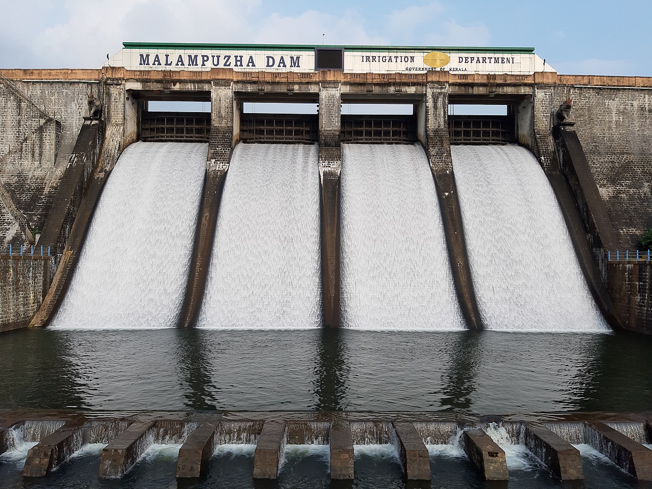
| അണക്കെട്ട് എഞ്ചിനീയർമാരുടെ വിശദാംശങ്ങൾ | ||
|---|---|---|
| ചീഫ് എഞ്ചിനീയർ | ചീഫ് എഞ്ചിനീയർ (Projects I) | |
| Superintending Engineer | Siruvani Project Circle Palakkad | |
| Executive Engineer | Irrigation Division Malampuzha | |
| പൊതു വിവരങ്ങൾ | |
|---|---|
| സംസ്ഥാനം | കേരളം |
| ജില്ല | പാലക്കാട് |
| താലൂക്ക്/വില്ലേജ് | പാലക്കാട്, മലമ്പുഴ |
| അക്ഷാംശം | Between 10° 48' and 10° 55' |
| രേഖാംശം | Between 76° 39' and 76° 42' |
| നദി | മലമ്പുഴ |
| പൂർത്തീകരിച്ച വർഷം | 1966 |
| ഡാമിന്റെ ഘടനാപരമായ സവിശേഷതകൾ | |
| ഘടന | കരിങ്കൽ അണ |
| മുകളിലത്തെ വീതി | കരിങ്കൽ അണ : 1626.71 മീറ്റർ മണ്ണ് ബണ്ട് : 222.20 മീ |
| താഴത്തെ വീതി | 21.336 M |
| നീളം | കരിങ്കൽ അണ : 1626.71 മീറ്റർ മണ്ണ് ബണ്ട് : 222.20 മീ |
| പരമാവധി ഉയരം | 38.10 മീ |
| ചരിവ്; അപ് സ്ട്രീം എഎംപി; നിന്നും ഡൗൺ സ്ട്രീം | Masonry 1:8U/S, 0.7:1 0.6:1 D/S |
| അണക്കെട്ടിന്റെ ജലശാസ്ത്ര സവിശേഷതകൾ | |
| വൃഷ്ടി പ്രദേശം | 147.635 ചതുരശ്ര കിലോമീറ്റർ |
| സാധ്യമായ പരമാവധി വെള്ളപ്പൊക്കം | 30000 ക്യുസെക്സ് |
| സ്പിൽവേ | |
| സ്ഥാനം | 110.49 മീ ചെയിനേജ് |
| Type | |
| ആകെ നീളം | 55 മീ |
| ക്രസ്റ്റ് ലെവൽ | 110.49M |
| സ്പിൽവെയുടെ ഡിസൈൻ കപ്പാസിറ്റി | 367 ക്യുമെക്സ് |
| ഗെയ്റ്റുകളുടെ എണ്ണം, തരം, വലുപ്പങ്ങൾ | 4 എണ്ണം 10.97 x 4.57 മീ |
| അണക്കെട്ടിന്റെ സവിശേഷതകൾ | |
| ടോപ്പ് ബാങ്ക് ലെവൽ | 117.35 മീ |
| മാക്സിമം വാട്ടർ ലെവൽ | 115.06 മീ |
| ഫുൾ റിസർവോയർ ലെവൽ | 115.06 മീ |
| മാക്സിമം ഡ്രോഡൗൺ ലെവൽ | 91.44മീ |
| ഡെഡ് സ്റ്റോറേജ് കപ്പാസിറ്റി | 2.40 മില്യൺ ഘനമീറ്റർ |
| ആകെ സ്റ്റോറേജ് കപ്പാസിറ്റി | 226 മില്യൺ ഘനമീറ്റർ |
| ഫ്രീ ബോർഡ് ഓവർ എഫ്.ആർ.എൽ | 2.29 മീ |
| എഫ്.ആർ.എൽ ലെ റിസർവോയർ ഏരിയ | 22 ചതുരശ്ര കിലോമീറ്റർ |
| ഫ്രീ ബോർഡ് ഓവർ എം.ഡബ്ല്യൂ.എൽ | 2.50മീ |
മംഗലം പദ്ധതി
മംഗലം നദിയുടെ കൈവഴിയായ ചെറുകുന്നം നദിക്ക് കുറുകെയാണ് മംഗലം അണക്കെട്ട് നിർമ്മിച്ചിട്ടുളളത്. മംഗലം അണക്കെട്ടിലൂടെയുളള ജലം വലതുകര ഇടതുകര കനാൽ ശൃംഖലകൾ വഴി വടക്കഞ്ചേരി, വണ്ടാഴി, കിഴക്കഞ്ചേരി, കണ്ണമ്പ്ര, പുതുക്കോട്, കാവ്വശ്ശേരി എന്നീ 6 പഞ്ചായത്തുകളിലെ 3440 ഹെക്ടറോളം പ്രദേശങ്ങളിലായി ജലസേചനം ചെയ്യുന്നു. ഫിഷറീസ് വകുപ്പിന് കീഴിലുള്ള വിവിധയിനം മത്സ്യങ്ങൾ കൃഷി ചെയ്യുന്നതിനും മംഗലം അണക്കെട്ട് ഉപയോഗിക്കുന്നു. ഫിഷറീസ് വകുപ്പിന്റെ കണക്കുപ്രകാരം മത്സ്യവിൽപ്പനയിലൂടെ പ്രതിവർഷം 11 മുതൽ 12 ലക്ഷം രൂപ വരെയാണ് വരുമാനം.

| അണക്കെട്ട് എഞ്ചിനീയർമാരുടെ വിശദാംശങ്ങൾ | ||
|---|---|---|
| Chief Engineer | Chief Engineer (Projects I) | |
| Superintending Engineer | Siruvani Project Circle Palakkad | |
| Executive Engineer | Irrigation Division Malampuzha | |
| പൊതു വിവരങ്ങൾ | |
|---|---|
| സംസ്ഥാനം | കേരളം |
| ജില്ല | പാലക്കാട് |
| താലൂക്ക്/വില്ലേജ് | ആലത്തൂർ, കിഴക്കഞ്ചേരി 11 |
| അക്ഷാംശം | 10° 31’ വടക്ക് |
| രേഖാംശം | 76° 32’ കിഴക്ക് |
| നദി | ചെറുകുന്നം പുഴ |
| പൂർത്തീകരിച്ച വർഷം | 1966 |
| ഡാമിന്റെ ഘടനാപരമായ സവിശേഷതകൾ | |
| തരം | കരിങ്കല്ലുകൊണ്ടും മണ്ണുകൊണ്ടും നിർമ്മിച്ചത് |
| & | കരിങ്കല്ലുകൊണ്ടും മണ്ണുകൊണ്ടും നിർമ്മിച്ചത് |
| മുകളിലത്തെ വീതി | Masonry- 6.25m |
| & | Earth Dam- 7.32m |
| താഴത്തെ വീതി | 17.34m |
| നീളം | മണ്ണണ 895 മീ. |
| & | കരിങ്കൽ അണ – 162 മീ. |
| പരമാവധി ഉയരം | ഗ്രാവിറ്റി ഡാം - 16.92മീ. |
| & | മണ്ണണ – 19.27 മീറ്റർ |
| ജലം ലഭിക്കുന്ന സ്ഥലത്തിന്റെ വ്യാപ്തി | Masonry - 0.007 Milliom m3 |
| ചരിവ്; അപ് സ്ട്രീം എഎംപി; നിന്നും ഡൗൺ സ്ട്രീം | 2:1 & 2.5:1 |
| അണക്കെട്ടിന്റെ ജലശാസ്ത്ര സവിശേഷതകൾ | |
| വൃഷ്ടി പ്രദേശം | 48.85 ച.കി.മീ |
| സാധ്യമായ പരമാവധി വെള്ളപ്പൊക്കം | 8650 ക്യുമെക്സ് |
| സ്പിൽവേ | |
| സ്ഥാനം | Over masonry |
| തരം | ഓജീ ഘടനspan> |
| പരമാവധി നീളം | 54.88 മീ |
| ക്രസ്റ്റ് ലെവൽ | +76.52മീ |
| സ്പിൽവേയുടെ ഡിസ്ചാർജ് കപ്പാസിറ്റി | 245 ക്യുമെക്സ് |
| ഗെയ്റ്റുകളുടെ എണ്ണം, തരം, വലുപ്പങ്ങൾ | |
| 3 എണ്ണം (8.69 മീ x 1.98 മീ)(3 Nos) | |
| & | 18.69 x1.38 (3 nos) |
| അണക്കെട്ടിന്റെ സവിശേഷതകൾ | |
| ഡാം ടോപ്പ് ലെവൽ | 80.95മീ |
| മാക്സിമം വാട്ടർ ലെവൽ | +77.88മീ. |
| ഫുൾ റിസർവോയർ ലെവൽ | +77.88മീ. |
| മിനിമം ഡ്രോഡൗൺ ലെവൽ | +64.00മീ. |
| ഡെഡ് സ്റ്റോറേജ് കപ്പാസിറ്റി | 0.15 മില്യൺ ഘനമീറ്റർ |
| ആകെ സ്റ്റോറേജ് കപ്പാസിറ്റി | 25.49മില്യൺ ഘനമീറ്റർ |
| ഫ്രീബോർഡ് ഓവർ എഫ്.ആർ.എൽ | & |
| എഫ്.ആർ.എൽ ലെ റിസർവോയർ ഏരിയ | 3.96 ച.മീ |
| Head Sluice | |
| ചോർച്ച നില | +64 |
ശിരുവാണി അണക്കെട്ട്
പാലക്കാട് ജില്ലയിലെ മണ്ണാർക്കാട് താലൂക്കിൽ ഭവാനി നദിയുടെ കൈവഴിയായ ശിരുവാണി നദിക്ക് കുറുകെ നിർമ്മിച്ചിരിക്കുന്ന അണക്കെട്ടാണ് ശിരുവാണി അണക്കെട്ട്. 1984 ൽ നിർമ്മിച്ച ശിരുവാണി അണക്കെട്ട് തമിഴ്നാട്ടിലെ കോയമ്പത്തൂർ നഗരത്തിലേക്ക് കുടിവെളളം എത്തിക്കാൻ ഉപയോഗിക്കുന്നു. കേരളത്തിലെയും തമിഴ്നാട്ടിലെയും റിസർവ് വനങ്ങളിലാണ് വൃഷ്ടിപ്രദേശം. അണക്കെട്ടിന്റെ കിഴക്കുഭാഗത്ത് സ്ഥിതി ചെയ്യുന്ന മുത്തിക്കുളം മലയിൽ നിന്നുളള വെളളച്ചാട്ടമാണ് അണക്കെട്ടിന്റെ പ്രധാന ഉറവിടം. 1930-ൽ ഇന്നത്തെ അണക്കെട്ടിന് മുകളിൽ ഒരു അണ നിർമ്മിക്കുകയും 1.80 മീറ്റർ വ്യാസമുളള തുരങ്കത്തിലൂടെ വെളളം കോയമ്പത്തൂരിലേക്ക് കൊണ്ടുപോകുകയും ചെയ്തു. സ്വാതന്ത്ര്യാനന്തരം സംസ്ഥാനങ്ങൾ രൂപീകൃതമായതിനുശേഷം ജലത്തിന്റെ വർദ്ധിച്ച ആവശ്യം കാരണം, ശിരുവാണിയിൽ നിന്ന് കോയമ്പത്തൂർ നഗരത്തിലേക്കും സമീപ പ്രദേശങ്ങളിലേക്കും കുടിവെളളം വിതരണം ചെയ്യുന്നതിനായി 1973 ആഗസ്റ്റിൽ ഇരു സംസ്ഥാന സർക്കാരുകൾ തമ്മിൽ കരാർ നടപ്പിലാക്കിയിരുന്നു. പ്രസ്തുത സ്ഥലം കേരള സംസ്ഥാനത്തിലായതിനാൽ, തമിഴ്നാട് സർക്കാർ ലഭ്യമാക്കിയ ഫണ്ട് ഉപയോഗിച്ച് കേരള പൊതുമരാമത്ത് വകുപ്പ് ശിരുവാണി കുടിവെളള വിതരണ പദ്ധതി നടപ്പിലാക്കുകയും 1984 -ൽ പ്രവൃത്തി പൂർത്തീകരിക്കുകയും ചെയ്തു.
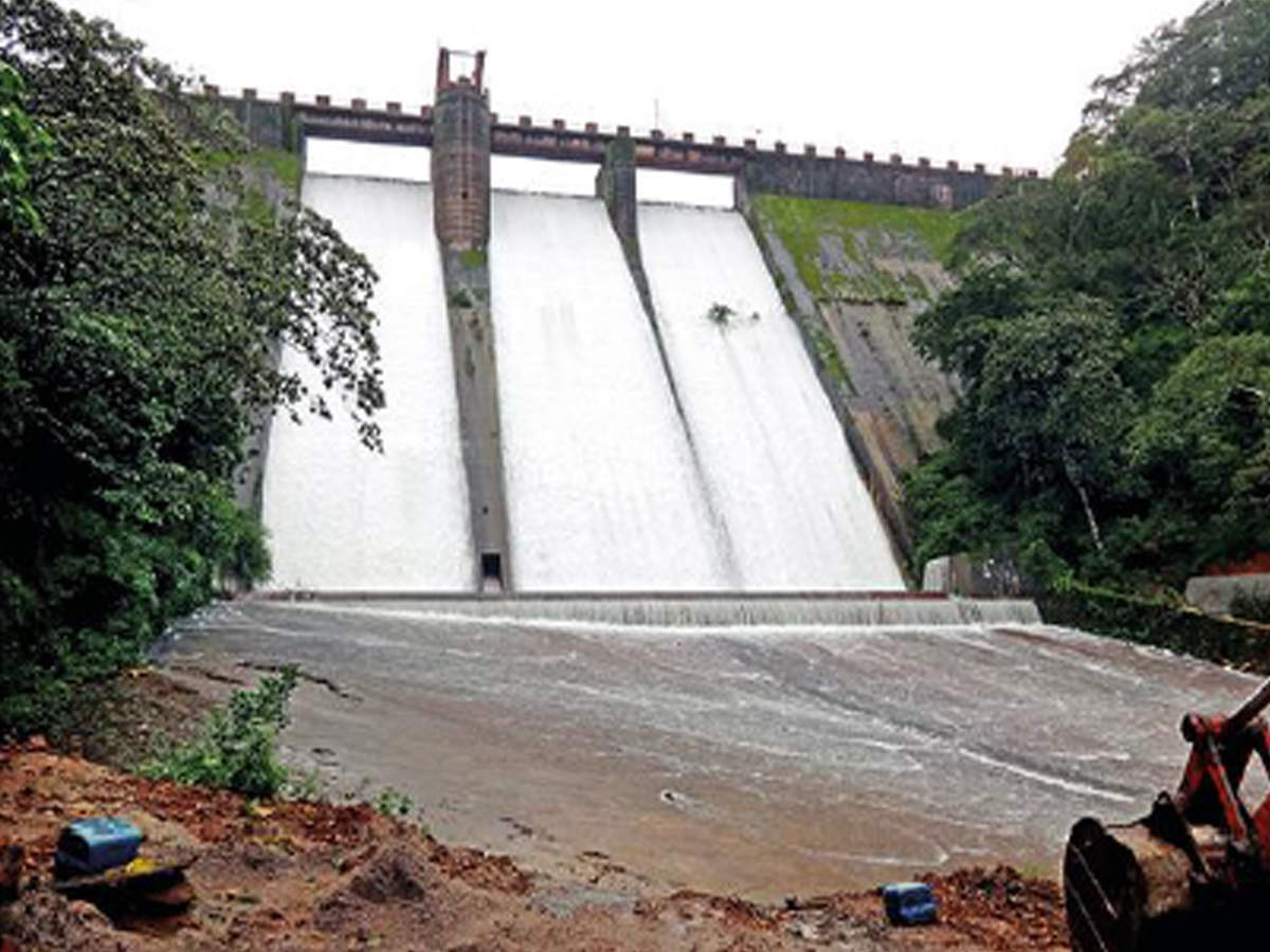
| പൊതു വിവരങ്ങൾ | |
|---|---|
| സംസ്ഥാനം | കേരളം |
| ജില്ല | പാലക്കാട് |
| താലൂക്ക്/വില്ലേജ് | ഷോളയാർ Panchayath |
| അക്ഷാംശം | 10° 58' 36" വടക്ക് |
| രേഖാംശം | 76° 38' 32" കിഴക്ക് |
| നദി | ശിരുവാണി പുഴ |
| പൂർത്തീകരിച്ച വർഷം | 1984 |
| ഡാമിന്റെ ഘടനാപരമായ സവിശേഷതകൾ | |
| Type | ഗ്രാവിറ്റി കല്ലണ |
| മുകളിലത്തെ വീതി | 4.36മീറ്റർ |
| താഴത്തെ വീതി | 17.34മീറ്റർ |
| നീളം | 224മീറ്റർ. |
| Maximum Height | 57m |
| Volume Content of Dam Body | 1,40,000m3. |
| ചരിവ്; അപ് സ്ട്രീം എഎംപി; നിന്നും ഡൗൺ സ്ട്രീം | Upstream- +829to860 1:10 and from 878 vertica stream Downstream 1:7 |
| അണക്കെട്ടിന്റെ ജലശാസ്ത്ര സവിശേഷതകൾ | |
| വൃഷ്ടി പ്രദേശം | 22.47 ചതുരശ്ര കിലോമീറ്റർ. |
| സാധ്യമായ പരമാവധി വെള്ളപ്പൊക്കം | 435 m3/sec |
| സ്പിൽവേ | |
| സ്ഥാനം | |
| ഘടന | ഓജീ ഘടന |
| നീളം | 49.40മീറ്റർ |
| ക്രസ്റ്റ് ലെവൽ | 878.50 മീറ്റർ. |
| സ്പിൽവേ ഡിസ്ചാർജ് കപ്പാസിറ്റി | 435ഘനമീറ്റർ /സെക്കന്റ്. |
| Number, type and sizes of gates | Nil |
| 5. അണക്കെട്ടിന്റെ സവിശേഷതകൾ | |
| Top bank Level | 883.00m |
| മാക്സിമം വാട്ടർ ലെവൽ | 881.5m. |
| ഫുൾ റിസർവോയർ ലെവൽ | 878.50. |
| കുറഞ്ഞ ഡ്രോഡൗൺ ലെവൽ | +64.00m. |
| ഡെഡ് സ്റ്റോറേജ് | 7.08മില്യൺ ഘനമീറ്റർ (250 Mcft) |
| മൊത്തം സംഭരണശേഷി | 25.50Mm3 |
| എഫ്.ആർ.എൽ ലെ വാട്ടർ സ്പ്രഡ് ഏരിയ | 1.636 ചതുരശ്ര കിലോമീറ്റർ |
കാഞ്ഞിരപ്പുഴ ജലസേചന പദ്ധതി
പാലക്കാട് ജില്ലയിലെ ഇടത്തരം ജലസേചന പദ്ധതികളില് ഒന്നാണ് കാഞ്ഞിരപ്പുഴ ജലസേചന പദ്ധതി. 1961 ൽ പ്രവൃത്തി ആരംഭിക്കുകയും 1980 ൽ പദ്ധതി ഭാഗികമായി കമ്മീഷൻ ചെയ്യുകയും ചെയ്തു. കാഞ്ഞിരപ്പുഴ ജലസേചന പദ്ധതിയുടെ പ്രധാന ലക്ഷ്യം രണ്ടാം വിളയ്ക്ക് ജലസേചന സൗകര്യം ഒരുക്കുക എന്നതാണ്. കൂടാതെ തെക്കു-പടിഞ്ഞാറൻ, വടക്കു-കിഴക്കൻ മൺസൂണിനിടയിലുള്ള ഡിസംബർ-ജനുവരി മാസങ്ങളിൽ മഴയുടെ അഭാവത്തിൽ കാർഷിക വിളകൾക്ക് ജലസേചനം നടത്തുക എന്നതിനും പദ്ധതി ലക്ഷ്യമിടുന്നു. പദ്ധതി ആവിഷ്കരിക്കുന്നതിനു മുമ്പ് ആയക്കട്ട് പ്രദേശങ്ങളിൽ ക്രമരഹിതമായ മഴയെ മാത്രം ആശ്രയിച്ചാണ് കൃഷി ചെയ്തിരുന്നത്. താരതമ്യേന ഈർപ്പം കൂടിയ താഴ്ന്ന പ്രദേശങ്ങളിൽ രണ്ട് വിളയും ഉയർന്ന പ്രദേശങ്ങളിൽ ഒരു വിളയും മാത്രമാണ് കൃഷി ചെയ്തിരുന്നത്. തെക്കു പടിഞ്ഞാറൻ മൺസൂണിനെ ആശ്രയിച്ചുള്ള ഒന്നാം വിളയുടെ വിത്ത് മെയ്മാസത്തിലെ ഒന്നോ രണ്ടോ മഴയ്ക്കു ശേഷമാണ് പാകുന്നത്. ഇതിന്റെ വിളവെടുപ്പ് കഴിഞ്ഞയുടൻ തന്നെ വാഴ, ഇഞ്ചി, പയർവർഗങ്ങൾ, പച്ചക്കറികൾ തുടങ്ങിയ ഇടക്കാല വിളകൾക്കായി നിലമൊരുക്കും. ഭാരതപ്പുഴയുടെ കൈവഴിയായ തൂതപ്പുഴയുടെ കൈവഴിയായ കാഞ്ഞിരപ്പുഴയ്ക്ക് കുറുകെ കാഞ്ഞിരപ്പുഴ ഗ്രാമ പഞ്ചായത്തിലെ പുളിയ്ക്കൽ എന്ന സ്ഥലത്താണ് കാഞ്ഞിരപ്പുഴ അണക്കെട്ട് നിർമ്മിച്ചിരിക്കുന്നത്. 9.36 കിലോമീറ്റർ നീളത്തിലുള്ള വലതുകര പ്രധാന കനാലും 61.71 കിലോമീറ്റർ നീളമുള്ള ഇടതുകര പ്രധാന കനാലും ഉൾപ്പെടുന്ന കനാൽ ശൃംഖലകൾ വഴി 9443 ഹെക്ടർ സ്ഥലത്ത് ജലസേചനം നടത്തുവാനാണ് പദ്ധതി വിഭാവനം ചെയ്യുന്നത്. അണക്കെട്ടിന് മുകൾ ഭാഗത്തായി 70 ചതുരശ്ര കിലോമീറ്റർ വിസ്തൃതിയുള്ള വൃഷ്ടി പ്രദേശം മുഴുവനായും സ്ഥിതി ചെയ്യുന്നത് കേരള സംസ്ഥാനത്തു തന്നെയാണ്.

| അണക്കെട്ട് എഞ്ചിനീയർമാരുടെ വിശദാംശങ്ങൾ | ||
|---|---|---|
| Chief Engineer | Chief Engineer (Projects I) | |
| Superintending Engineer | Siruvani Project Circle Palakkad | |
| Executive Engineer | KPIP Division Kanhirapuzha Division | |
| പൊതു വിവരങ്ങൾ | |
|---|---|
| സംസ്ഥാനം | കേരളം |
| ജില്ല | പാലക്കാട് |
| താലൂക്ക്/വില്ലേജ് | മണ്ണാർക്കാട്/കാഞ്ഞിരപ്പുഴ |
| അക്ഷാംശം | 58' വടക്ക് |
| രേഖാംശം | 72° 32' കിഴക്ക് |
| നദി | കാഞ്ഞിരപ്പുഴ |
| പൂർത്തീകരിച്ച വർഷം | 1983 |
| ഡാമിന്റെ ഘടനാപരമായ സവിശേഷതകൾ | |
| ഘടന | മണ്ണ് അണക്കട്ട് 1896മീറ്റർ മേസൺറി അണക്കെട്ട് ഡാം 231.60മീറ്റർ |
| മുകളിലത്തെ വീതി | E-7.50m M- 4.90മീറ്റർ |
| താഴത്തെ വീതി | E-146.00m M- 28.95 മീറ്റർ |
| നീളം | E-1896.40m M-231.60മീറ്റർ |
| പരമാവധി ഉയരം | 30.78m |
| Level | |
| ഡാം ബോഡി ഉള്ളടക്കം | 1511000 ഘനമീറ്റർ |
| ചരിവ്; അപ് സ്ട്രീം | E-1: 2.5 to 1:3.50 M- 10:1 |
| ഡൗൺ സ്ട്രീം | 1:2 to 1:2.50 10:6 to 10: 8.5 |
| അണക്കെട്ടിന്റെ ജലശാസ്ത്ര സവിശേഷതകൾ | |
| വൃഷ്ടി പ്രദേശം | 70.00 Sq. Km |
| പ്രൊബബിൾ മാക്സിമം ഫ്ലഡ് | 504.00 ക്യുമെക്സ് |
| സ്പിൽവേ | |
| സ്ഥാനം | മധ്യഭാഗം |
| ഘടന | ഓഗീ ടൈപ്പ് |
| ആകെ നീളം | 36.6 മീറ്റർ |
| ക്രസ്റ്റ് ലെവൽ | + 92.95 മീറ്റർ |
| സ്പിൽവേയുടെ ഡിസൈൻ കപ്പാസിറ്റി | 512.55 ക്യുമെക്സ് |
| ഗയ്റ്റുകളുടെ എണ്ണം, തരം, വലുപ്പങ്ങൾ | ലംബ ലിഫ്റ്റ് ഗേറ്റ് 3x 12.20 x 4.5744 മീറ്റർ |
| അണക്കെട്ടിന്റെ സവിശേഷതകൾ | |
| അണക്കെട്ടിന്റെ മുകൾ ഭാഗം | 100.28 മീറ്റർ |
| പരമാവധി ജലനിരപ്പ് | +97.50 മീറ്റർ |
| ഫുൾ റിസർവോയർ ലെവൽ | +97.535 മീറ്റർ |
| മിനിമം ഡ്രോ ഡൗൺ ലെവൽ | +77.400മീറ്റർ |
| ഡെഡ് സ്റ്റോറേജ് കപ്പാസിറ്റി | 1.557 മില്യൺ ഘനമീറ്റർ |
| ആകെ സംഭരണശേഷി | 70.8274 മില്യൺ ഘനമീറ്റർ |
| ഫ്രീബോർഡ് ഓവർ എഫ്.ആർ.എൽ | 2.745 m |
| റിസർവോയർ ഏരിയ എഫ്.ആർ.എൽ | 4.65 m |
| ഫ്രീബോർഡ് ഓവർ മാക്സിമം വാട്ടർ ലെവൽ | 2.78 മീറ്റർ |
കുറ്റ്യാടി ജലസേചന പദ്ധതി
കാർഷിക ആവശ്യങ്ങൾക്കുള്ള ജലം സംഭരിച്ചു ജലസേചനം നടത്തുന്നതിനായി 1962 ൽ നിർമാണം ആരംഭിച്ച് 1973 ൽ ഭാഗികമായും 1993 ൽ പൂർണ്ണമായും കമ്മീഷൻ ചെയ്ത കോഴിക്കോട് ജില്ലയിലെ ഏക ജലസേചനപദ്ധതിയാണ് കുറ്റ്യാടി ജലസേചന പദ്ധതി. കുറ്റ്യാടി പുഴക്ക് കുറുകെ പെരുവണ്ണാമൂഴിയിൽ അണകെട്ടി 603 കി.മി. ഓളം വരുന്ന കനാൽ ശൃംഖല വഴി കോഴിക്കോട് ജില്ലയിലെ 14569 ഹെക്ടറിൽ ജലവിതരണം നടത്താനാണ് ഈ പദ്ധതി വിഭാവനം ചെയ്തത്. ഈ പദ്ധതിയിൽ 2 മെയിൻ കനാലുകളും, 10 ബ്രാഞ്ച് കനാലുകളും, 70 ഡിസ്ട്രിബ്യൂട്ടറികളും, 107 സബ് ഡിസ്ട്രിബ്യൂട്ടറികളും ഫീൽഡ് ബോത്തികളും ഉൾക്കൊള്ളുന്നു. വടകര, കൊയിലാണ്ടി, കോഴിക്കോട് താലൂക്കുകളിലായി 44 ഗ്രാമ പഞ്ചായത്തുകളിലും 3 മുനിസിപ്പാലിറ്റികളിലും കോഴിക്കോട് കോർപറേഷനിലുമായി വ്യാപിച്ചു കിടക്കുന്ന കനാൽ ശൃംഖല വഴി ജില്ലയിലെ 10232 ഹെക്ടറോളം സ്ഥലത്തു ഈ പദ്ധതി ജലസേചനം നടത്തി വരുന്നു. കോഴിക്കോട് ജില്ലയെ വരൾച്ചയിൽ നിന്നും വലിയൊരു പരിധി വരെ സംരക്ഷിച്ചു നിർത്തുന്നത് കെ.വൈ.ഐ.പി. കനാലുകളിലൂടെയുള്ള കാര്യക്ഷമമായ ജലവിതരണമാണ്. കാർഷിക ആവശ്യങ്ങൾക്ക് പുറമെ കോഴിക്കോട് കോർപ്പറേഷനിലും അനുബന്ധ പഞ്ചായത്തുകളിലും കുടിവെള്ളമെത്തിക്കുന്ന 174 MLD കപ്പാസിറ്റിയുള്ള JBIC പദ്ധതിക്ക് ആവശ്യമായ വെള്ളത്തിന്റെ സ്രോതസ്സ് കുറ്റ്യാടി ജലസേചന പദ്ധതിയുടെ റിസർവോയർ തന്നെയാണ്. കൂടാതെ കൊയിലാണ്ടി മുനിസിപ്പാലിറ്റിയും നാലോളം പഞ്ചായത്തുകളും ഉൾക്കൊള്ളുന്ന കിഫ്ബി കുടിവെള്ള പദ്ധതി ഈ പദ്ധതിയെ ആശ്രയിച്ച് തന്നെയാണ് വിഭാവനം ചെയ്തിരിക്കുന്നത്.

| പൊതു വിവരങ്ങൾ | |
|---|---|
| സംസ്ഥാനം | കേരളം |
| ജില്ല | കോഴിക്കോട് |
| താലൂക്ക്/വില്ലേജ് | കൊയിലാണ്ടി/വടകര |
| അക്ഷാംശം | 11° 36' 45" വടക്ക് |
| രേഖാംശം | 75° 49' 27" കിഴക്ക് |
| നദി | കുറ്റ്യാടി |
| പൂർത്തീകരിച്ച വർഷം | 1993 |
| 2. ഡാമിന്റെ ഘടനാപരമായ സവിശേഷതകൾ | |
| ഘടന (1) (2) | പ്രധാന അണക്കെട്ട് –ഗ്രാവിറ്റി ഡാം സാഡിൽ അണക്കെട്ട് - മണ്ണ് അണ 13Nos. Earth dam |
| മുകളിലത്തെ വീതി | 11.13 മീ |
| താഴത്തെ വീതി | 25.40മീ |
| Maximum Ht from lowest Foundation | 35.36 മീ |
| 3. അണക്കെട്ടിന്റെ ജലശാസ്ത്ര സവിശേഷതകൾ | |
| വൃഷ്ടി പ്രദേശം | 108. 78. ചതുരശ്ര കിലോമീറ്റർ |
| പ്രൊബബിൾ മാക്സിമം ഫ്ലഡ് | 1071.75 ഘനമീറ്റർ/സെ |
| പിഎംഎഫ് കണക്കാക്കുന്നതിനുള്ള രീതി | Ryversquo;s formula |
| 4. സ്പിൽവേ | |
| സ്ഥാനം | അക്ഷാംശം- 11° 36' 45" വടക്ക് രേഖാംശം- 75° 49' 27" കിഴക്ക് |
| ഘടന | ഓജീ ഘടന |
| ആകെ നീളം | 48.8 |
| ക്രസ്റ്റ് ലെവൽ | 38.44മീറ്റർ |
| ഡിസൈൻ കപ്പാസിറ്റി ഓഫ് സ്പിൽവേ | 1444 ഘനമീറ്റർ/സെ |
| ഗെയ്റ്റുകളുടെ എണ്ണം തരം, വലുപ്പങ്ങൾ | 4 എണ്ണം, 12.2 മീ. X 7.62 മീ. റേഡിയൽ ഷട്ടർ |
| 5. അണക്കെട്ടിന്റെ സവിശേഷതകൾ | |
| ടോപ്പ് ബാങ്ക് ലെവൽ | +46.85 മീറ്റർ |
| മാക്സിമം വാട്ടർ ലെവൽ | +44.61 മീറ്റർ |
| ഫുൾ റിസർവോയർ ലെവൽ | 44.41 മീറ്റർ |
| മിനിമം ഡ്രോ ഡൗൺ ലെവൽ | +25.52മീറ്റർ |
| ഡെഡ് സ്റ്റോറേജ് കപ്പാസിറ്റി | 7.08 മില്യൺ ഘനമീറ്റർ |
| ഗ്രോസ് സ്റ്റോറേജ് കപ്പാസിറ്റി | 120.52മില്യൺ ഘനമീറ്റർ |
| ഫ്രീ ബോർഡ് ഓവർ എഫ്.ആർ.എൽ | 2.44 മീറ്റർ |
| എഫ്.ആർ.എൽ ലെ റിസർവൊയർ ഏരിയ | 1052 ചതുരശ്ര കിലോമീറ്റർ. |
| ഫ്രി ബോർഡ് ഓവർ എം.ഡബ്ല്യൂ.എൽ | 2.44 മീറ്റർ |
| 6. ഹെഡ് സ്ലൂയിസ് | |
| സിൽ ലെവൽ | 25.52 മീ |
വാളയാർ പദ്ധതി
പാലക്കാട് ജില്ലയിൽ തമിഴ്നാട് അതിർത്തിയോട് ചേർന്നാണ് വാളയാർ ജലസംഭരണി സ്ഥിതി ചെയ്യുന്നത്. കേരളത്തിലെ ഇടത്തരം പദ്ധതികളിൽ ഒന്നാണ് വാളയാർ പദ്ധതി. ഇതിൽ വാളയാർ അണക്കെട്ടും നെട്ടു അയ്യർ, വടശ്ശേരി, കൗണ്ടൻ, നെല്ലിശ്ശേരി, തട്ടാൻ, ചാലായി, കോവിലകം, പൊന്നാംപിള്ള, വനഭോജനം എന്നിങ്ങനെയുള്ള ആനിക്കട്ടുകളും അതിന്റെ കനാൽ സംവിധാനങ്ങളും ഈ പദ്ധതിയിൽ ഉൾപ്പെടുന്നു. വാളയാർ പദ്ധതി 150 മീറ്റർ സ്പിൽവേ ഭാഗം ഉൾപ്പെടെ 1478 മീറ്റർ നീളത്തിൽ ഇരുവശത്തും മൺ അണക്കെട്ടിനാൽ ചുറ്റപ്പെട്ട ഒരു മാസൺറി ഗ്രാവിറ്റി അണക്കെട്ട് ആണ്.

| പൊതു വിവരങ്ങൾ | |
|---|---|
| സംസ്ഥാനം | കേരളം |
| ജില്ല | പാലക്കാട് |
| താലൂക്ക്/വില്ലേജ് | പാലക്കാട് / പുതുശ്ശേരി കിഴക്ക് |
| അക്ഷാംശം | 10° 43', 10° 52' വടക്ക് |
| രേഖാംശം | 76° 42' and 76° 50' കിഴക്ക് |
| നദി | വാളയാർ നദി (ഭാരതപ്പുഴയുടെ കൈവഴി) |
| ഡാമിന്റെ ഘടനാപരമായ സവിശേഷതകൾ | |
| ഘടന | മാസൺറി ഡാം എർത്തേൻ ഡാമിനാൽ ചുറ്റപ്പെട്ട |
| മുകളിലത്തെ വീതി | മാസൺറി 3.6 മീ |
| താഴത്തെ വീതി | 21.60 മീ |
| നീളം | Masonry 150 മീ, മണ്ണ് - 328 മീ |
| ബെഡ് ലെവലിൽ നിന്ന് പരമാവധി ഉയരം | 28.105 മീ |
| ചരിവ് - അപ്സ്ട്രീം and താഴോട്ട് | മണ്ണ് - 2.5 : 1 മാസൺറി- 2 :1 |
| അണക്കെട്ടിന്റെ ജലശാസ്ത്ര സവിശേഷതകൾ | |
| വൃഷ്ടി പ്രദേശം | 106.35Sq. KM |
| സാധ്യമായ പരമാവധി വെള്ളപ്പൊക്കം | 396.40 ക്യുമെക്സ് |
| Method of estimating PMF | നിലവിലെ മീറ്റർ രീതി |
| സ്പിൽവേ | |
| സ്ഥാനം | മധ്യഭാഗം |
| ഘടന | ലംബ ലിഫ്റ്റ് ഘടന |
| മൊത്തം നീളം | 42m |
| ക്രസ്റ്റ് ലെവൽ | +199.95m |
| ഡിസൈൻ കപ്പാസിറ്റി ഓഫ് സ്പിൽവേ | 396.40 ക്യുമെക്സ് |
| ഗയ്റ്റുകളുടെ എണ്ണം, തരം, വലുപ്പങ്ങൾ | 3 nos. size 12 x 3 m |
| അണക്കെട്ടിന്റെ സവിശേഷതകൾ | |
| Top bank Level | +205.00m |
| മാക്സിമം വാട്ടർ ലെവൽ | +203.00m |
| ഫുൾ റിസർവോയർ ലെവൽ | +203.00m |
| ഏറ്റവും കുറഞ്ഞ ഡ്രോഡൗൺ ലെവൽ | +182.575m |
| ഡെഡ് സ്റ്റോറേജ് കപ്പാസിറ്റി | Nil |
| മൊത്തം സംഭരണശേഷി | 18.40Mm3 |
| ഫ്രീബോർഡ് ഓവർ എഫ്.ആർ.എൽ. | 2.04m |
| ഫ്രീബോർഡ് ഓവർ എം.ഡബ്ല്യു.എൽ | 2.04m |
| റിസർവോയർ ഏരിയ എഫ്.ആർ.എൽ | 2.59 Sq. Km |
| ഹെഡ് സ്ലൂയിസ് | |
| Sill level | +182.575m and +188.975m |
| Spill Channel | സ്വാഭാവികം നദി |
മീങ്കര പദ്ധതി
കേരളത്തിലെ പാലക്കാട് ജില്ലയിലാണ് മീങ്കര ജലസേചന പദ്ധതി സ്ഥിതി ചെയ്യുന്നത്. പാലക്കാട് ജില്ലയിലെ ഭാരതപ്പുഴയുടെ കൈവഴിയായ മീങ്കര നദിക്ക് കുറുകെയാണ് മീങ്കര അണക്കെട്ട് നിർമ്മിച്ചിരിക്കുന്നത്, 3035 ഹെക്ടറാണ് പദ്ധതിയുടെ ആയകട്ട്. ഗായത്രി ജലസേചന പദ്ധതിയുടെ ആദ്യ ഘട്ടമാണ് മീങ്കര പദ്ധതി. ഈ പദ്ധതി 1956-ൽ ഏറ്റെടുക്കുകയും 1960-ൽ ഭാഗികമായി കമ്മീഷൻ ചെയ്യുകയും 1964-ൽ പൂർത്തിയാക്കുകയും ചെയ്തു. റിസർവോയറിന്റെ മൊത്ത സംഭരണശേഷി 11.30 Mm3 ആണ്. 90.65 ചതുരശ്ര കിലോമീറ്റർ വൃഷ്ടിപ്രദേശമുണ്ട്. കേരളത്തിലെ ഒരു വിവിധോദ്ദേശ്യ ജലസംഭരണിയാണ് മീങ്കര റിസർവോയർ. മീങ്കര റിസർവോയറിൽ സംഭരിക്കുന്ന വെള്ളം പ്രധാനമായും ജലസേചനത്തിനും സംഭരണത്തിന്റെ ഒരു ചെറിയ ഭാഗം സമീപ പ്രദേശങ്ങളിലെ കുടിവെള്ള വിതരണത്തിനും ഉപയോഗിക്കുന്നു. കാർഷിക ആവശ്യങ്ങൾക്കുള്ള ജലവിതരണം സാധാരണയായി എല്ലാ വർഷവും നവംബർ മാസത്തിൽ ആരംഭിച്ച് ഫെബ്രുവരി അല്ലെങ്കിൽ മാർച്ച് വരെ തുടരും. ആയകട്ടിൽ കൃഷി ചെയ്യുന്ന പ്രധാന വിള നെല്ലാണ്. ചിറ്റൂർ താലൂക്കിലെ മുതലമട പഞ്ചായത്തിലാണ് ജലസംഭരണി സ്ഥിതി ചെയ്യുന്നത്.

| അണക്കെട്ട് എഞ്ചിനീയർമാരുടെ വിശദാംശങ്ങൾ | ||
|---|---|---|
| Chief Engineer | Chief Engineer (Projects I) | |
| Superintending Engineer | Siruvani Project Circle Palakkad | |
| Executive Engineer | Irrigation Division Chittoor | |
| പൊതു വിവരങ്ങൾ | |
|---|---|
| സംസ്ഥാനം | കേരളം |
| ജില്ല | പാലക്കാട് |
| താലൂക്ക്/വില്ലേജ് | ചിറ്റൂർ /മുതലമട |
| അക്ഷാംശം | 10° 38' വടക്ക് |
| രേഖാംശം | 76° 48' കിഴക്ക് |
| നദി | മീങ്കര |
| പൂർത്തീകരിച്ച വർഷം | 1964 |
| ഡാമിന്റെ ഘടനാപരമായ സവിശേഷതകൾ | |
| ഘടന | സോണൽ തരത്തിലുള്ള എർത്ത് ഡാം |
| മുകളിലത്തെ വീതി | 7.0 മീ |
| താഴെ വീതി | 70.0മീ. |
| നീളം | മണ്ണ് -964 മീ. മേസണറി – 30 മീ. |
| പരമാവധി ഉയരം | 18.9m. |
| ഡാം ബോഡിയുടെ വ്യാപ്തം | Earth work - 0.91 Million m3 Masonry - 0.007 Million m3 Concrete - 0.00229 Million m3 |
| ചരിവ് - Upstream and Down stream | U/s ചരിവ് 2:1,2.5:1,3:1 D/s ചരിവ്2:1,2.5:1,3:1 |
| അണക്കെട്ടിന്റെ ജലശാസ്ത്ര സവിശേഷതകൾ | |
| വൃഷ്ടി പ്രദേശം | 90.65 ചതുരശ്ര കിലോമീറ്റർ |
| സാധ്യമായ പരമാവധി വെള്ളപ്പൊക്കത്തിന്റെ അളവ് | 472.60 ക്യുമെക്സ് |
| സ്പിൽവേ | |
| സ്ഥാനം | വലത് വശം |
| ഘടന | Ogee ടൈപ്പ് |
| ആകെ നീളം | 30 മീ. |
| ക്രസ്റ്റ് ലെവൽ | 151.79 മീ |
| സ്പിൽവേയുടെ ഡിസൈൻ കപ്പാസിറ്റി | 472.60 ക്യുമെക്സ് |
| ഗേറ്റുകളുടെ എണ്ണം, തരം, വലുപ്പങ്ങൾ | 2 എണ്ണം, ലംബ ലിഫ്റ്റ് തരം 12.19*4.57 മീ |
| അണക്കെട്ടിന്റെ സവിശേഷതകൾ | |
| പരമാവധി ജലനിരപ്പ് | +156.36മീ. |
| ഫുൾ റിസർവോയർ ലെവൽ | +156.36മീ. |
| മിനിമം ഡ്രോഡൗൺ ലെവൽ | +143.64മീ. |
| ഡെഡ് സ്റ്റോറേജ് കപ്പാസിറ്റി | 1.0 മില്യൺ ഘനമീറ്റർ |
| മൊത്ത സംഭരണശേഷി | 11.33 മില്യൺ ഘനമീറ്റർ |
| എഫ്.ആർ.എൽ നു മുകളിലെ ഫ്രീബോർഡ് | 2.48m |
| റിസർവോയർ ഏരിയ എഫ്.ആർ.എൽ | 249.50 ഹെക്ടർ |
| M.W.L നു മുകളിലെ ഫ്രീ ബോർഡ് | 2.44m |
ചുള്ളിയാർ അണക്കെട്ട്
ഭാരതപ്പുഴയുടെ കൈവഴിയായ ഗായത്രി നദിക്ക് കുറുകെയാണ് ചുള്ളിയാർ അണക്കെട്ട് നിർമ്മിച്ചിരിക്കുന്നത്. ഇത് ഗായത്രി പദ്ധതിയുടെ രണ്ടാം ഘട്ടമാണ്, 1961-ൽ ഏറ്റെടുത്തു. പദ്ധതി 1966-ൽ ഭാഗികമായി കമ്മീഷൻ ചെയ്യുകയും 1970-ൽ പൂർത്തീകരിക്കുകയും ചെയ്തു. മീങ്കര റിസർവോയറുമായി ചുള്ളിയാറിന് ഒരു ലിങ്ക് കനാൽ ഉണ്ട്. ഇത് നിറഞ്ഞാൽ മീങ്കരയിൽ നിന്ന് വെള്ളം തിരിച്ചുവിടാൻ ഉപയോഗിക്കുന്നു. പലകപ്പാണ്ടി ലിങ്ക് കനാൽ അതിന്റെ തെക്ക്-പടിഞ്ഞാറ് ഭാഗത്ത് റിസർവോയറിൽ ചേരുന്നു. ഈ കനാൽ പാലകപ്പാണ്ടി വെള്ളച്ചാട്ടത്തിൽ നിന്ന് തിരിച്ചുവിടുന്ന വെള്ളം കൊണ്ടുപോകുന്നു. മുതലമട, കൊല്ലങ്കോട്, എലവഞ്ചേരി, നെന്മാറ, പല്ലശ്ശന ഗ്രാമപഞ്ചായത്തുകളിലായി വ്യാപിച്ചുകിടക്കുന്ന പദ്ധതിയുടെ ആകെ അയക്കെട്ട് 2430 ഹെക്ടർ ആണ്. അയക്കെട്ടിൽ കൃഷി ചെയ്യുന്ന പ്രധാന വിള നെല്ലാണ്.
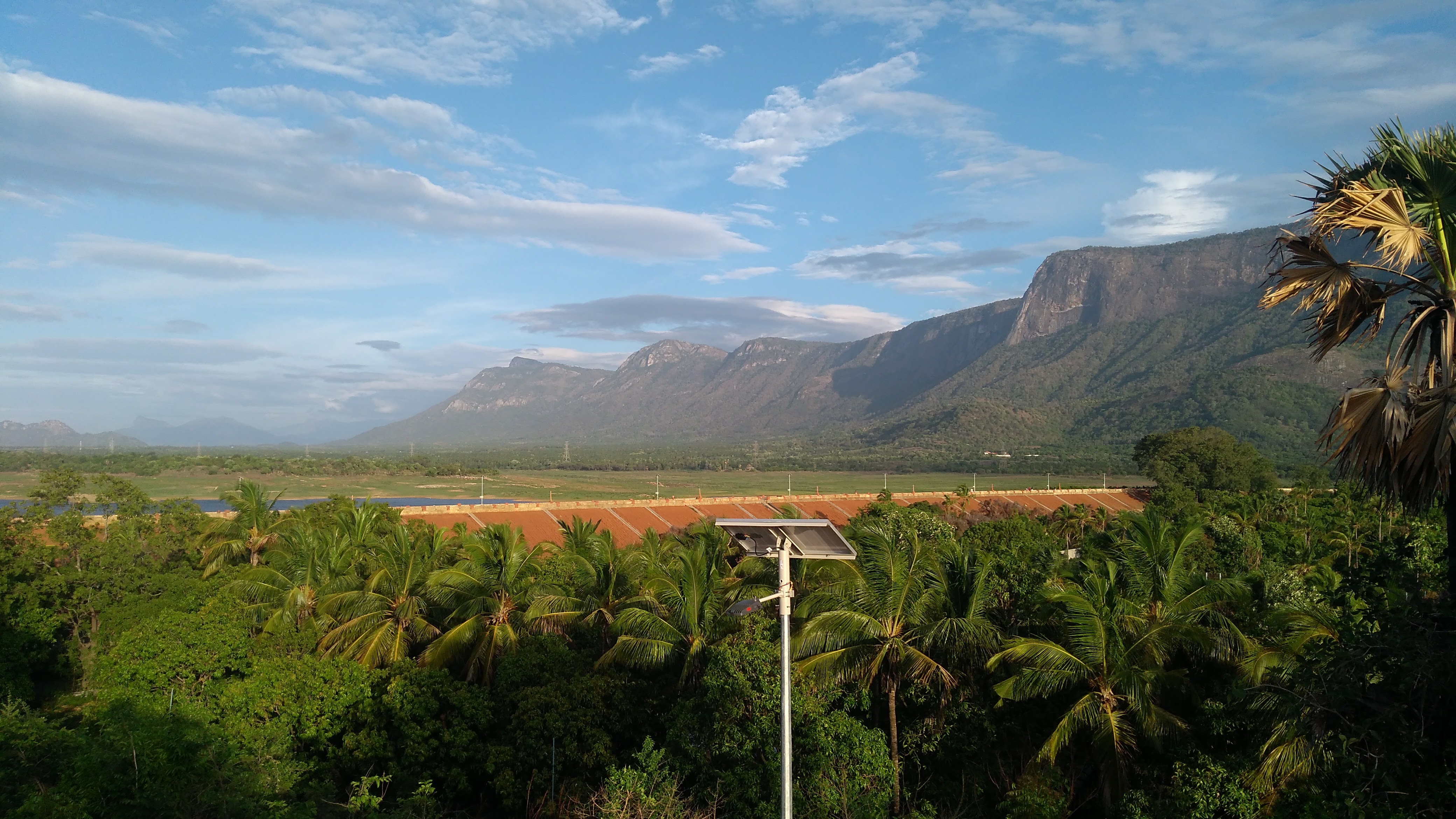
| അണക്കെട്ട് എഞ്ചിനീയർമാരുടെ വിശദാംശങ്ങൾ | ||
|---|---|---|
| Chief Engineer | Chief Engineer (Projects I) | |
| Superintending Engineer | Siruvani Project Circle Palakkad | |
| Executive Engineer | Irrigation Division Chittoor | |
| പൊതു വിവരങ്ങൾ | |
|---|---|
| സംസ്ഥാനം | കേരളം |
| ജില്ല | പാലക്കാട് |
| താലൂക്ക്/വില്ലേജ് | ചിറ്റൂർ /മുതലമട |
| അക്ഷാംശം | 10° 43' and 10° 52' വടക്ക് |
| രേഖാംശം | 76° 42' and 76° 50' കിഴക്ക് |
| നദി | ഗായത്രി നദി (ഭാരതപ്പുഴയുടെ കൈവഴി) |
| ഡാമിന്റെ ഘടനാപരമായ സവിശേഷതകൾ | |
| ഘടന | എർത്തേൻ ഡാമിനാൽ ചുറ്റപ്പെട്ട മാസൺറി ഡാം earthen dams |
| മുകളിലത്തെ വീതി | 4.85 മീ |
| താഴെ വീതി | 21.60m |
| നീളം | മണ്ണ് -700m. കൊത്തുപണി - 555m സാഡിൽ – 500 m |
| ബെഡ് ലെവലിൽ നിന്ന് പരമാവധി ഉയരം | 30.50 m |
| ചരിവ് - Upstream and Down stream | മണ്ണ് - 2.5 : 1 മാസൺറി- 2 :1 |
| അണക്കെട്ടിന്റെ ജലശാസ്ത്ര സവിശേഷതകൾ | |
| വൃഷ്ടി പ്രദേശം | 27.80 കി.മീ2 |
| സാധ്യമായ പരമാവധി വെള്ളപ്പൊക്കം | 223.70 ക്യുമെക്സ് |
| PMF കണക്കാക്കുന്ന രീതി | നിലവിൽ മീറ്റർ രീതി |
| സ്പിൽവേ | |
| സ്ഥാനം | Middle portion |
| ഘടന | Vertical lift ഘടന |
| ആകെ നീളം | 30 മീ |
| ക്രസ്റ്റ് ലെവൽ | +151.03 മീ |
| സ്പിൽവേയുടെ ഡിസൈൻ കപ്പാസിറ്റി | 223.70 ക്യുമെക്സ് |
| ഗേറ്റുകളുടെ എണ്ണം, തരം, വലുപ്പങ്ങൾ | 3 എണ്ണം, ലംബ ലിഫ്റ്റ് തരം 7.6 x 3.05 മീ |
| അണക്കെട്ടിന്റെ സവിശേഷതകൾ | |
| ടോപ്പ് ബാങ്ക് ലെവൽ | +155.60മി |
| മാക്സിമം വാട്ടർ ലെവൽ | +203.00m |
| ഫുൾ റിസർവോയർ ലെവൽ | +203.00m |
| മിനിമം ഡ്രോഡൗൺ ലെവൽ | +136.55മീ |
| ഡെഡ് സ്റ്റോറേജ് കപ്പാസിറ്റി | 1.00 എംഎം3 |
| മൊത്ത സംഭരണശേഷി | 13.70 എംഎം3 |
| എഫ്.ആർ.എൽ നു മുകളിലെ ഫ്രീബോർഡ് | 1.52 മീ |
| M.W.L നു മുകളിലെ ഫ്രീ ബോർഡ് | 1.52 മീ |
| റിസർവോയർ ഏരിയ എഫ്.ആർ.എൽ | 1.65 Km2 |
| Head Sluice | |
| Sill level | +182.575m and +188.975m |
| Spill Channel | Natural River |
പോത്തുണ്ടി പദ്ധതി
നെല്ലിയാമ്പതി മലനിരകളിൽ നിന്ന് ഉത്ഭവിക്കുന്ന അയിലൂർ നദിയുടെ കൈവഴികളായ മീഞ്ചാടിപ്പുഴയ്ക്കും നെൽപ്പുഴയ്ക്കും കുറുകെയുള്ള ഒരു മണ്ണ് അണക്കെട്ടും പാലക്കാട് ജില്ലയിലെ ചിറ്റൂർ, ആലത്തൂർ താലൂക്കുകളിലെ 4785 ഹെക്ടർ സ്ഥലങ്ങളിൽ ജലസേചനം നടത്തുന്നതിനുള്ള കനാൽ ശൃംഖലകളും അടങ്ങിയതാണ് പോത്തുണ്ടി ജലസേചന പദ്ധതി. നെന്മാറ, അയിലൂർ, ഇലവഞ്ചേരി, മേലാർകോട്, വടക്കഞ്ചേരി, വണ്ടാഴി, എരിമയൂർ എന്നീ ഏഴ് പഞ്ചായത്തുകളിലെ ആയകട്ട് പ്രദേശങ്ങളിൽ വലതുകര, ഇടതുകര കനാലുകൾ വഴി ജലസേചനത്തിനായി അണക്കെട്ടിലൂടെയുള്ള വെള്ളം വിതരണം ചെയ്യുന്നു. 1984 മുതൽ കേരള വാട്ടർ അതോറിറ്റി, നെന്മാറ, അയിലൂർ, മേലാർകോട് എന്നീ 3 പഞ്ചായത്തുകളിലെ കുടിവെള്ള വിതരണത്തിന് പോത്തുണ്ടി അണക്കെട്ടിൽ നിന്നുള്ള വെള്ളം ഉപയോഗിക്കുന്നു. ഫിഷറീസ് വകുപ്പിന് കീഴിലുള്ള വിവിധയിനം മത്സ്യങ്ങൾ കൃഷി ചെയ്യുന്നതിനും പോത്തുണ്ടി അണക്കെട്ട് ഉപയോഗിക്കുന്നു. ഇടത്, വലത് കര കനാലുകളിലൂടെയാണ് പ്രധാനമായും ആയകട്ട് പ്രദേശത്തെ 90% സ്ഥലത്ത് കൃഷി ചെയ്യുന്ന നെൽകൃഷിക്ക് വെള്ളം വിതരണം ചെയ്യുന്നത്.
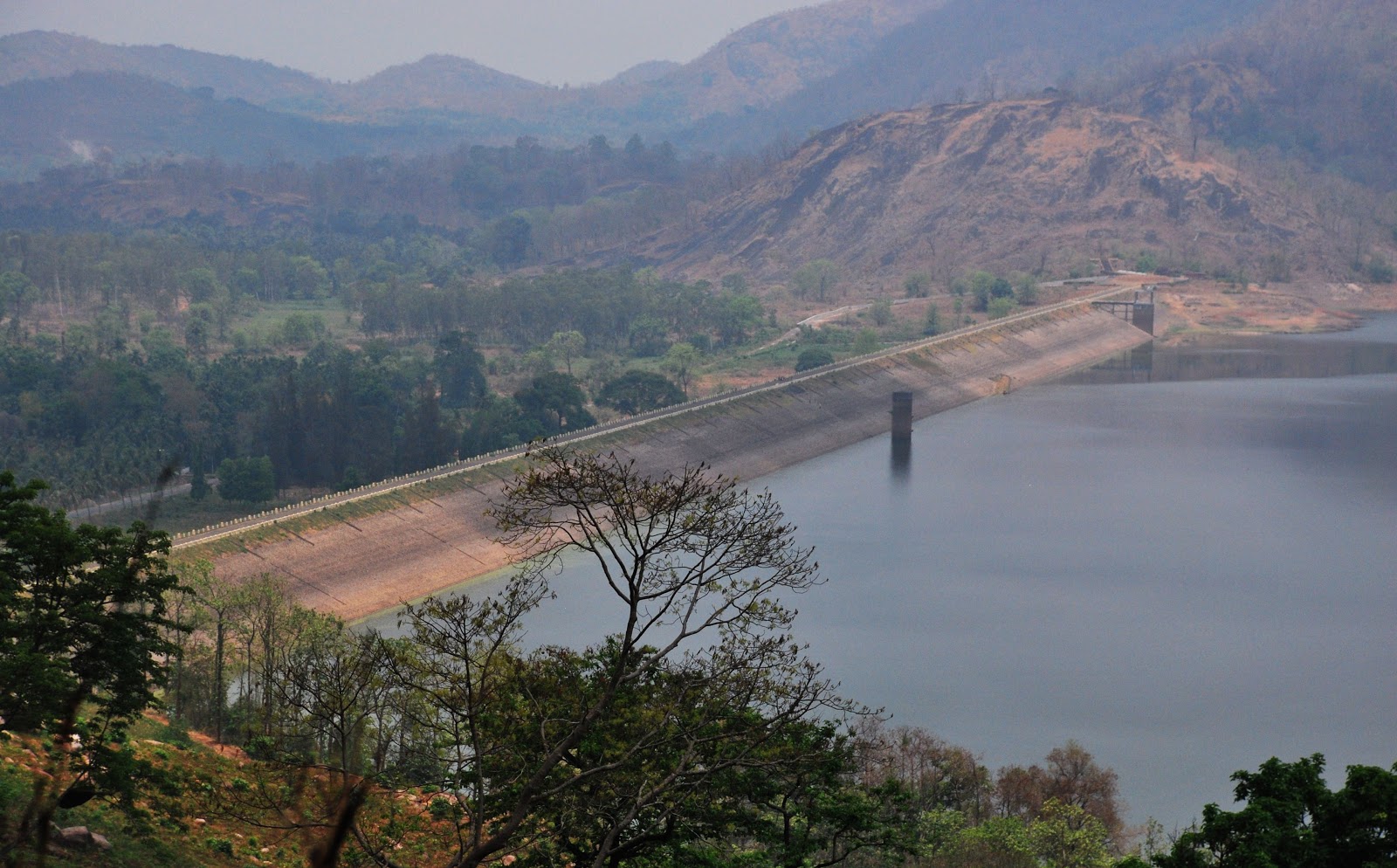
| അണക്കെട്ട് എഞ്ചിനീയർമാരുടെ വിശദാംശങ്ങൾ | ||
|---|---|---|
| Chief Engineer | Chief Engineer (Projects I) | |
| Superintending Engineer | Siruvani Project Circle Palakkad | |
| Executive Engineer | Irrigation Division Malampuzha | |
| പൊതു വിവരങ്ങൾ | |
|---|---|
| സംസ്ഥാനം | കേരളം |
| ജില്ല | പാലക്കാട് |
| താലൂക്ക്/വില്ലേജ് | ചിറ്റൂർ |
| അക്ഷാംശം | 10° 31'48.31” വടക്ക് |
| രേഖാംശം | 76°22’11.56” കിഴക്ക് |
| നദി | അയിലൂർ (ഭാരതപ്പുഴയുടെ കൈവഴി) |
| ഡാമിന്റെ ഘടനാപരമായ സവിശേഷതകൾ | |
| ഘടന | മണ്ണണ |
| മുകളിലത്തെ വീതി | 7.32 മീ |
| താഴത്തെ വീതി | 133.8 മീ |
| നീളം | 1680 മീ |
| ഫൗണ്ടേഷനിൽ നിന്നുള്ള പരമാവധി ഉയരം | 32.61 മീ |
| ചരിവ്; അപ് സ്ട്രീം എഎംപി; നിന്നും ഡൗൺ സ്ട്രീം | 2:1, 2:1 |
| അണക്കെട്ടിന്റെ ജലശാസ്ത്ര സവിശേഷതകൾ | |
| വൃഷ്ടി പ്രദേശം | 31 ച.കി.മീ |
| സാധ്യമായ പരമാവധി വെള്ളപ്പൊക്കം | 680 ക്യുമെക്സ് |
| Method of estimating PMF | Current Meter Method |
| സ്പിൽവേ | |
| സ്ഥാനം | Right Flank of Dam |
| ഘടന | ഓജീ ടൈപ്പ് |
| ആകെ നീളം | 1680 മീറ്റർ |
| ക്രസ്റ്റ് ലെവൽ | +104.09 മീറ്റർ |
| ഡിസൈൻ കപ്പാസിറ്റി ഓഫ് സ്പിൽവേ | 682.44 ക്യുമെക്സ് |
| ഗയ്റ്റുകളുടെ എണ്ണം, തരം, വലുപ്പങ്ങൾ | 3, (12.19X 4.11), Level shutters |
| അണക്കെട്ടിന്റെ സവിശേഷതകൾ | |
| ടോപ്പ് ബാങ്ക് ലെവൽ | +110.642 മീറ്റർ |
| മാക്സിമം വാട്ടർ ലെവൽ | +108.204 മീറ്റർ |
| ഫുൾ റിസർവോയർ ലെവൽ | +108.204 മീറ്റർ |
| ഏറ്റവും കുറഞ്ഞ ഡ്രോഡൗൺ ലെവൽ | 91.44 മീറ്റർ |
| ഡെഡ് സ്റ്റോറേജ് കപ്പാസിറ്റി | 7.014 മില്യൺ ഘനമീറ്റർ |
| ആകെ സ്റ്റോറേജ് കപ്പാസിറ്റി | 50.914 മില്യൺ ഘനമീറ്റർ |
| ഫ്രീ ബോർഡ് ഓവർ എഫ്.ആർ.എൽ | 2.42 മീറ്റർ |
| എഫ്.ആർ.എൽ ലെ വാട്ടർ സ്പ്രെഡ് ഏരിയ | 2.75 sq.kms |
| 6. Head Sluice | |
| Sillevel | +91.44m |
പമ്പ ജലസേചന പദ്ധതി
ശബരിഗിരി ജലവൈദ്യുത പദ്ധതിയുടെ 287 ച.കി.മീ വൃഷ്ടിപ്രദേശത്ത് വാൽ റേസ് ജലത്തിൻ്റെ ഉറച്ച പുറന്തള്ളൽ ഉപയോഗപ്പെടുത്തുകയാണ് പമ്പ ജലസേചന പദ്ധതി ലക്ഷ്യമിടുന്നത്. പമ്പാനദിക്ക് കുറുകെ ആനത്തോട്, കക്കിയാറിന് കുറുകെ കക്കി എന്നിവിടങ്ങളിൽ അണക്കെട്ട് രൂപപ്പെട്ട റിസർവോയറിൽ. വാൽ-റേസ് വെള്ളം കക്കാട് നദിയിലേക്ക് വിടുകയും മണിയാറിൽ ഒരു ബാരേജ് വഴി ശേഖരിക്കുകയും ചെയ്യുന്നു. ഇങ്ങനെ ശേഖരിക്കുന്ന വെള്ളം നദിയുടെ ഇടതുകരയിലെ കനാൽ വഴി തിരിച്ചുവിടുന്നു. ഈ പദ്ധതി 21135 ഹെക്ടർ ജലസേചനം ചെയ്യുന്നു. (നെറ്റ്) മൊത്തത്തിൽ 49456 ഹെക്ടർ. കനാൽ സംവിധാനത്തിൻ്റെ നെറ്റ് വർക്കിലൂടെ പത്തനംതിട്ട, ആലപ്പുഴ ജില്ലകളിൽ ഭൂമി. 20 കിലോമീറ്റർ നീളമുള്ള പ്രധാന കനാൽ, 20.23 കിലോമീറ്റർ നീളമുള്ള വലതുകര കനാൽ, 47.15 കിലോമീറ്റർ നീളമുള്ള ഇടത് കര കനാൽ എന്നിവയാണ് കനാലിൽ ഉൾപ്പെടുന്നത്. പദ്ധതി 1993-ൽ പൂർത്തിയായതായി പ്രഖ്യാപിച്ചു.

| General | |
|---|---|
| സംസ്ഥാനം | കേരളം |
| ജില്ല | പത്തനംതിട്ട |
| താലൂക്ക്/വില്ലേജ് | റാന്നി താലൂക്ക്/ വടശേരിക്കര ഗ്രാമം |
| അക്ഷാംശം | 9° 20' വടക്ക് |
| രേഖാംശം | 76° 53' കിഴക്ക് |
| നദി | പമ്പ നദിയുടെ പോഷകനദിയായ കക്കാട് നദി |
| ഘടന | ഇരുവശത്തും ബൾക്ക്ഹെഡ് ഭാഗങ്ങളാൽ ചുറ്റപ്പെട്ട ഒരു കേന്ദ്ര സ്പിൽവേ ഭാഗം. ബൾക്ക്ഹെഡുകൾ എന്നത് സ്ട്രെയിറ്റ് ഗ്രാവിറ്റി ടൈപ്പ് റാൻഡം റബിൾ മേസൺറി ഡാമുകളാണ്, അവ കോഴ്സ്ഡ് റബിൾ ഫേസിംഗ് ഉള്ളവയാണ്. സ്പിൽവേ ഭാഗം സിമന്റ് മോർട്ടാറിൽ ആഷ്ലാർ ഓജി ഭാഗമുള്ള റാൻഡം റബിൾ മേസൺറി കൊണ്ടാണ് നിർമ്മിച്ചിരിക്കുന്നത്. ആർ.സി.സി.യും അപ്സ്ട്രീം അഭിമുഖവും. |
| മുകളിലത്തെ വീതി | 5.48 M |
| താഴത്തെ വീതി | 13.25 M |
| Length | 115.22 M |
| കിടക്ക നിരപ്പിൽ നിന്നുള്ള പരമാവധി ഉയരം | 16.76 M |
| Slope upstream and down stream | 1. ഇരുവശത്തുമുള്ള ബൾക്ക് ഹെഡ് അപ്സ്ട്രീം ഫെയ്സ് - 1:10 18.29 മീ മുതൽ 21.62 മീ വരെയും ലംബമായി 21.64 മീ മുതൽ മുകളിൽ നിന്ന് താഴേക്കുള്ള സ്ട്രീം ഫെയ്സ് - 1:1.1 18.28 മീ മുതൽ 21.64 മീ വരെയും, 0.65:1 21.64 മീ മുതൽ 24.69 മീ വരെയും, 0.4:1 24.69 മീ മുതൽ 30.78 മീ വരെയും, ലംബമായി 30.78 മീ മുതൽ 36.88 മീ വരെയും |
| 2. Spill way portion | |
| അപ്സ്ട്രീം ഫെയ്സ് ndash; ബൾക്ക് ഹെഡ് ഡൗൺ സ്ട്രീം ഫെയ്സിന്റേതിന് സമാനമാണ്; പീച്ചിയിലെ കെഇആർഐയിൽ നടത്തിയ മോഡൽ പഠനങ്ങളെ അടിസ്ഥാനമാക്കിയുള്ളതാണ് ഓജി പ്രൊഫൈൽ. ബൗളിനും തറയ്ക്കും ഇടയിലുള്ള പരിവർത്തനം 6.70M ആരമുള്ള വളഞ്ഞ തറയുള്ള ഒരു സ്റ്റില്ലിംഗ് ബേസിൻ ആയി നൽകിയിരിക്കുന്നു. | |
| അണക്കെട്ടിന്റെ ജലശാസ്ത്ര സവിശേഷതകൾ | |
| വൃഷ്ടി പ്രദേശം | 287 Sq.Km |
| പരമാവധി വെള്ളപ്പൊക്ക സാധ്യത (PMF) | 1280 ക്യുമെക്സ് |
| PMF കണക്കാക്കുന്ന രീതി | By Ryve's formula |
| സ്പിൽവേ | |
| സ്ഥാനം | തടയണയുടെ മധ്യഭാഗത്ത് |
| ഘടന | സിമന്റ് മോർട്ടാറിൽ റാൻഡം റബിൾ ഉപയോഗിച്ച് ആഷ്ലാർ ഓഗീ അഭിമുഖീകരിക്കുന്നതും ആർ.സി.സി. മുകളിലേക്ക് അഭിമുഖീകരിക്കുന്നതും |
| Total Length | 64.31 M |
| ക്രസ്റ്റ് ലെവൽ | 29.26 M |
| ഡിസൈൻ കപ്പാസിറ്റി ഓഫ് സ്പിൽവേ | 1287 ക്യുമെക്സ് |
| ഗയ്റ്റുകളുടെ എണ്ണം, തരം, വലുപ്പങ്ങൾ | 5 nos. Vertical Lift ഘടന ndash; size 10.70M x 5.50M |
| അണക്കെട്ടിന്റെ സവിശേഷതകൾ | |
| Top Bank Level | 36.83M |
| മാക്സിമം വാട്ടർ ലെവൽ | 35.35 M |
| ഫുൾ റിസർവോയർ ലെവൽ | 34.62 M |
| കുറഞ്ഞ ഡ്രോ ഡൗൺ ലെവൽ | 29.26 M |
| ഡെഡ് സ്റ്റോറേജ് കപ്പാസിറ്റി | |
| മൊത്തം സംഭരണശേഷി | 8 Mm3 |
| ഫ്രീബോർഡ് ഓവർ എഫ്.ആർ.എൽ | 2.21 M |
| ഫ്രീബോർഡ് ഓവർ എം.ഡബ്ല്യു.എൽ | 1.48 M |
| റിസർവോയർ ഏരിയ എഫ്.ആർ.എൽ. | 1.08 Sq.Km |
| 6. Head Sluice | |
| Spill way | 31.09 M |
| Spill Channel | No spill channel |
| Instrumentation | Nil |
പഴശ്ശി ജലസേചന പദ്ധതി.
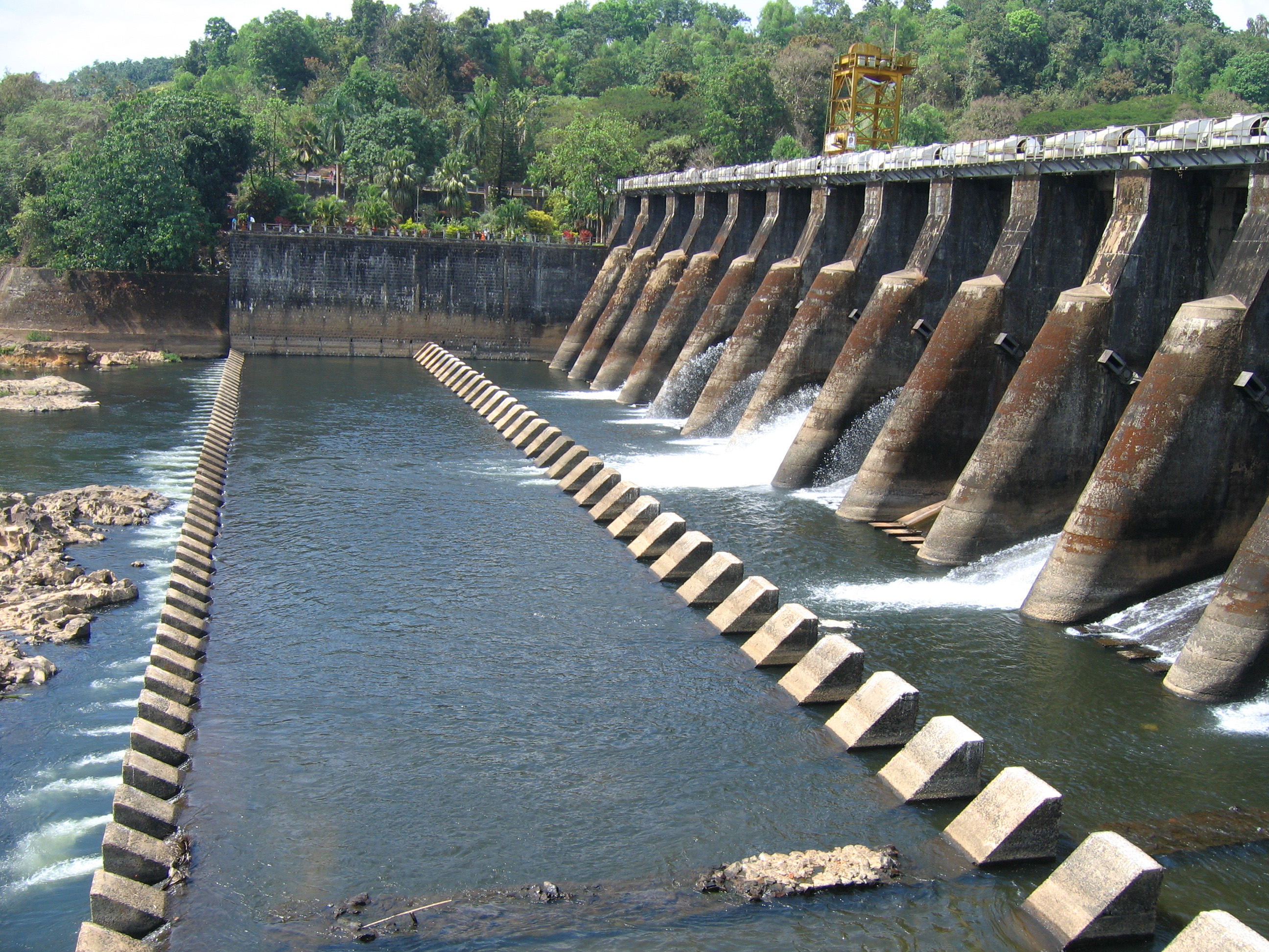
ഉത്തരകേരളത്തിലെ ആദ്യത്തെ ജലസേചന പദ്ധതിയാണ് പഴശ്ശി ജലസേചന പദ്ധതി. പദ്ധതിയുടെ നിർമ്മാണം 1961 ൽ ആരംഭിക്കുകയും 1998 ൽ പൂർത്തീകരിക്കുകയും ചെയ്തു. പശ്ചിമഘട്ടത്തിൽ നിന്ന് ഉത്ഭവിച്ച് അറബിക്കടലിലേക്ക് ഒഴുകുന്ന വളപട്ടണം പുഴയ്ക്ക് കുറുകെ കുയില്ലൂർ (വെളിയമ്പ്ര) എന്ന സ്ഥലത്ത് സ്ഥിതി ചെയ്യുന്ന ഒരു ഡൈവേർഷൻ ബാരേജ് ആണ് പഴശ്ശി ബാരേജ്. കണ്ണൂർ ജില്ലയിലെ ഇരിട്ടി, തലശ്ശേരി, കണ്ണൂർ, തളിപ്പറമ്പ് എന്നീ അഞ്ച് താലൂക്കുകളിലായി 16500 ഹെക്ടർ ആയക്കട്ട് പ്രദേശത്തെ രണ്ടാംവിള ജലസേചനത്തിനു വേണ്ടിയാണ് പദ്ധതി വിഭാവനം ചെയ്തിരുന്നത്. എന്നാൽ വിവിധ കാരണങ്ങളാൽ കാർഷിക ഭൂമിയിൽ ലഭ്യത കുറവ് വരികയും കാർഷിക രീതിയിൽ മാറ്റം വരികയും ചെയ്തതിനാൽ ആയക്കട്ട് വിസ്തീർണ്ണം 11525 ഹെക്ടർ ആയി ചുരുങ്ങി. 46 കിലോമീറ്റർ നീളമുള്ള പ്രധാന കനാലും, ആകെ 75 കിലോമീറ്റർ നീളമുള്ള 6 ബ്രാഞ്ച് കനാലുകളും, (മാഹി, എടക്കാട്, അഴീക്കൽ, കാട്ടാമ്പള്ളി, തളിപ്പറമ്പ്, മൊറാഴ) 165 കിലോമീറ്റർ ദൈർഘ്യമുള്ള ഡിസ്ട്രിബ്യൂട്ടറികളും, 118 കിലോമീറ്റർ ദൈർഘ്യമുള്ള ഫീൽഡ് ബോത്തികളും ഉൾപ്പെടെ 404 കിലോമീറ്റർ ദൈർഘ്യമുള്ള കനാൽ ശൃംഖലയാണ് പ്രസ്തുത പദ്ധതിയിൽ ഉൾപ്പെട്ടിട്ടുള്ളത്. കണ്ണൂർ ജില്ലയിലും മാഹിയിലുമായി കെ.ഡബ്ല്യൂ.എ യുടെ 12 കുടിവെള്ള പദ്ധതികളുടെ ഉറവിടം കൂടിയാണ് ഈ ജലസംഭരണി. കൂടാതെ റിസർവോയർ വെള്ളം ഉപയോഗിച്ച് കെ.എസ്.ഇ.ബി 7.50 മെഗാവാട്ട് ശേഷിയുള്ള ഒരു മിനി ഹൈഡൽ പദ്ധതി ആരംഭിച്ചിട്ടുണ്ട്.
| അണക്കെട്ട് എഞ്ചിനീയർമാരുടെ വിശദാംശങ്ങൾ | ||
|---|---|---|
| Chief Engineer | Chief Engineer (Projects I) | |
| Superintending Engineer | Project Circle kannur | |
| Executive Engineer | PYIP Division II Kannur | |
| പൊതു വിവരങ്ങൾ | |
|---|---|
| ജില്ല | കണ്ണൂർ |
| താലൂക്ക്/വില്ലേജ് | തലശ്ശേരി |
| അക്ഷാംശം | 11° 5939' 00" വടക്ക് |
| രേഖാംശം | 75° 3739' 00" കിഴക്ക് |
| നദി | വളപട്ടണം നദി |
| ഡാമിന്റെ ഘടനാപരമായ സവിശേഷതകൾ | |
| ഘടന | മാസൺറി ബാരേജ്. |
| മുകളിലത്തെവീതി (Bulk Head) | 5.49 മീറ്റർ |
| താഴത്തെ വീതി (-do-) | 14.02 മീ |
| നീളം | 245 മീ |
| പരമാവധി ഉയരം | 18.29 മീ |
| ചരിവ്; അപ് സ്ട്രീം | Vertical |
| Down stream | 2:1. |
| അണക്കെട്ടിന്റെ ജലശാസ്ത്ര സവിശേഷതകൾstrong> | |
| വൃഷ്ടി പ്രദേശം | 640 ചതുരശ്ര കിലോമീറ്റർ |
| പ്രൊബബിൾ മാക്സിമം ഫ്ലഡ് (PMF) | 3510 ക്യുമെക്സ് |
| Method of Estimating PMF | Unit Hydrograph |
| സ്പിൽവേ | |
| സ്ഥാനം | കുയിലൂർ |
| ഘടന | മെസൻറി |
| ആകെ നീളം | 138 മീറ്റർ |
| ക്രസ്റ്റ് ലെവൽl | 13.72 മീറ്റർ |
| Design Capacity of spill way | 3500 ക്യുമെക്സ് |
| ഗെയ്റ്റുകളുടെ എണ്ണം, തരം, വലുപ്പങ്ങൾ | 16 nos. Radial (6.1 x 5.18 M size) |
| അണക്കെട്ടിന്റെ സവിശേഷതകൾ | |
| ടോപ്പ് ബാങ്ക് ലെവൽ | 27.52 മീറ്റർ |
| പരമാവധി ജലനിരപ്പ് | 27.44 മീറ്റർ |
| ഫുൾ റിസർവോയർ ലെവൽ | 26.52 മീറ്റർ |
| മാക്സിമം ഡ്രോ ഡൗൺ ലെവൽ | 24.66 മീറ്റർ |
| ഡെഡ് സ്റ്റോറേജ് കപ്പാസിറ്റി | Nil |
| ഗ്രോസ് സ്റ്റോറേജ് കപ്പാസിറ്റി | 97.5 മില്യൺ ഘനമീറ്റർ |
| ഫ്രീ ബൊർഡ് ഓവർ എഫ്.ആർ.എൽ | 1 മീറ്റർ |
| Free board over M W L | 1.48 M |
| എഫ്.ആർ.എൽ ലെ അണക്കെട്ടിന്റെ വിസ്തീർണ്ണം | 650 ഹെക്ടർ |
| Head Sluice | |
| Spill way | 24.66 M |
| Spill Channel | Nil |
| Instrumentation | Electrically operated radial |
പെരിയാർ വാലി ജലസേചന പദ്ധതി
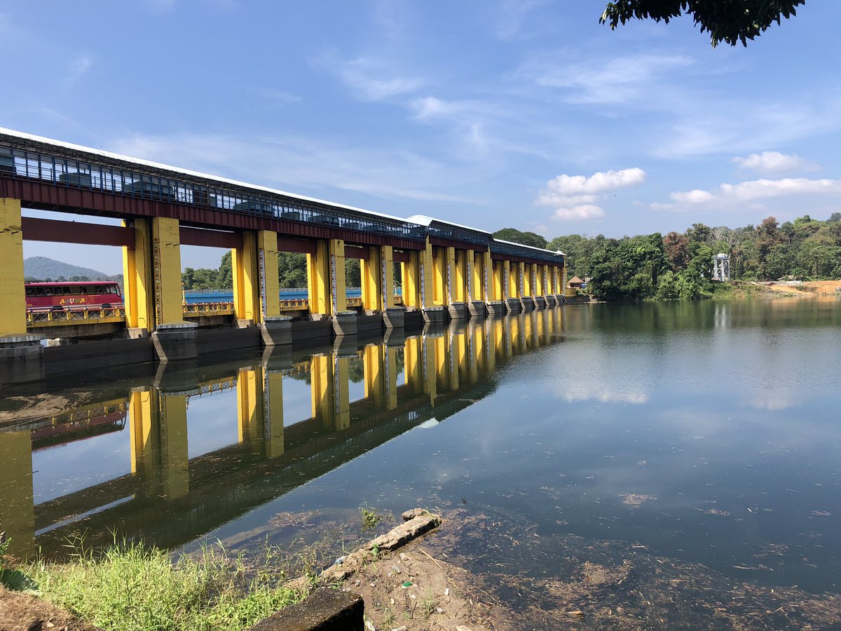
പെരിയാർ വാലി ജലസേചന പദ്ധതി വിഭാവനം ചെയ്തിരിക്കുനത് പെരിയാറിൻ്റെ മുതിരപ്പുഴ കൈവഴിയിലെ പൂർത്തീകരിച്ച ഹൈഡൽ സ്കീമുകളിൽ നിന്നുള്ള ടെയിൽ റേസ് ഡിസ്ചാർജും, ഇടമലയാർ പോഷകനദിക്ക് കുറുകെ കെഎസ്ഇബി ഹൈഡൽ സ്കീമിന് കീഴിൽ നിർമ്മിച്ച എണ്ണക്കൽ അണക്കെട്ടിൽ നിന്നുള്ള നിയന്ത്രിത പുറന്തള്ളലും പെരിയാർ നദിയുടെ വൃഷ്ടിപ്രദേശത്ത് നിന്ന് അനിയന്ത്രിതമായ ഒഴുകി വരുന്ന വെള്ളവും ഉപയോഗപ്പെടുത്തി ഇടതുകരയിൽ നിന്നും കനാൽ സംവിധാനത്തിൻ്റെയും നിയന്ത്രണ ഉപകരണങ്ങളുടെയും ശൃംഖലയിലൂടെ 32800 ഹെക്ടർ പ്രദേശത്തെ ജലസേചനത്തിനായാണ്. എറണാകുളം ജില്ലയിലെ കോതമംഗലം, മൂവാറ്റുപുഴ, കുന്നത്തുനാട്, ആലുവ, കണയന്നൂർ, പറവൂർ താലൂക്കുകളിൽ 32800 ഹെക്ടർ പ്രദേശത്ത് ആദ്യ രണ്ട് വിളകളായ വിരുപ്പും മുണ്ടകനും ജലസേചന സൗകര്യം ഒരുക്കാനാണ് പദ്ധതി വിഭാവനം ചെയ്യുന്നത്. ഇത് കൂടാതെ 20,000 ഹെക്ടർ മൂന്നാം വിള (പുഞ്ച) സമയത്തും നനയ്ക്കും. അങ്ങനെ പദ്ധതികളുടെ മൊത്തം വിസ്തീർണ്ണം85,600ഹെക്ടറാണ്. പെരിയാറിൻ്റെ ഇടത് കരയിലും ഐഐപി പദ്ധതിയുടെ വലത് കരയിലും ജലസേചനം നടത്തുന്നതിനും നദിയിലൂടെ കുറഞ്ഞ അളവിൽ വെള്ളം വിതരണം ചെയ്ത് താഴ്ന്ന പ്രദേശങ്ങളിലെ ലവണാംശം പരിശോധിക്കുന്നതിനും പെരിയാറിൻ്റെ നിരവധി എൽഐ പദ്ധതികളുടെ ആവശ്യകതകൾ നിറവേറ്റുന്നതിനും പുറമെ, കുടിവെള്ളത്തിനും വ്യാവസായിക ആവശ്യങ്ങൾക്കുമുള്ള വെള്ളവും ഭൂതത്താൻകെട്ടിലെ ബാരേജിലെ സംഭരണ ജലത്തിൻ്റെ ഒരു ഭാഗം കണ്ടെത്തും. വർഷം മുഴുവനും വെള്ളം വിതരണം ചെയ്യുന്ന ചുരുക്കം ചില പദ്ധതികളിൽ ഒന്നാണിത്. കോതമംഗലം താലൂക്കിലെ ഭൂതത്താൻകെട്ടിലെ തടയണയാണ് പദ്ധതിയിൽ ഉൾപ്പെടുന്നത്. വൈദുതിയില് പ്രവർത്തിപ്പിക്കുന്ന 15 എണ്ണം ഫ്രെയിം ചെയ്ത സ്റ്റീൽ ഷട്ടറുകളുടെ ഇതിന് നൽകിയിട്ടുണ്ട്. 8 കിലോമീറ്റർ നീളമുള്ള മെയിൻ കനാൽ, 20.78 കിലോമീറ്റർ നീളമുള്ള ലോ ലെവൽ കനാൽ, 24.312 കിലോമീറ്റർ നീളമുള്ള ഹൈലെവൽ കനാൽ, മൊത്തം 694.718 കിലോമീറ്റർ നീളമുള്ള വിതരണ ശൃംഖല എന്നിവയാണ് പദ്ധതിയുടെ പ്രധാന ഘടകങ്ങൾ. ലോ ലെവൽ കനാൽ 1967-ലും ഹൈ ലെവൽ കനാൽ 1988-ലും കമ്മീഷൻ ചെയ്തു. പദ്ധതി 1992-ൽ പൂർത്തിയായതായി പ്രഖ്യാപിച്ചു.
| General | |
|---|---|
| സംസ്ഥാനം | കേരളം |
| ജില്ല | എറണാകുളം |
| താലൂക്ക്/വില്ലേജ് | Kothamangalam |
| അക്ഷാംശം | 10° 0839' 16" വടക്ക് |
| രേഖാംശം | 76° 4039" 00" കിഴക്ക് |
| നദി | പെരിയാർ |
| ഡാമിന്റെ ഘടനാപരമായ സവിശേഷതകൾ | |
| Type ndash; If more than one type give details of each type | Masonry barrage. |
| മുകളിലത്തെ വീതി (pillars) | 2.44 m-12 pillars side span, 3.96 m-2 |
| താഴത്തെ വീതി (-do-) | 3.04m-12 pillar side span, 3.96m-2 |
| Length | 210.92 M |
| Height of barrage | 11.79 M |
| Slope- Upstream; Down stream | |
| അണക്കെട്ടിന്റെ ജലശാസ്ത്ര സവിശേഷതകൾ | |
| Catchments Area | Total 3048 sq.km,Free catchment 938 sq.km. |
| Probable Maximum Flood (PMF) | 7079 ക്യുമെക്സ് |
| Method of Estimating PMF | |
| സ്പിൽവേ | |
| സ്ഥാനം | |
| ഘടന | |
| Total Length | 173.7 M |
| ക്രസ്റ്റ് ലെവൽ | Central span-24.59m, side span-25.81 |
| ഡിസൈൻ കപ്പാസിറ്റി ഓഫ് സ്പിൽവേ | 7370 ക്യുമെക്സ് |
| ഗയ്റ്റുകളുടെ എണ്ണം, തരം, വലുപ്പങ്ങൾ | 15nos. ventways provided with electrically operated framed steel shutters with vertical lifting arrangements. Size of gates: 3nos. - 9.14*10.36m.12nos - 12.19m*9.14m |
| അണക്കെട്ടിന്റെ സവിശേഷതകൾ | |
| Top Bank Level | 36.43 M |
| മാക്സിമം വാട്ടർ ലെവൽ | 34.95 M |
| ഫുൾ റിസർവോയർ ലെവൽ | 34.95 M |
| Minimum draw down level | |
| ഡെഡ് സ്റ്റോറേജ് കപ്പാസിറ്റി | |
| Gross storage capacity | 169.79 mm3 |
| Free board over F R L | 1.48 M |
| Free board over M W L | 1.48 M |
| Area of Reservoir at F R L | 16.4 Sq.Km |
| Head Sluice | |
| Spill way | |
| Spill Channel | Nil |
| Instrumentation | Nil |


